MM08 Slippery Rock , Pennsylvania - Earthquake Result Viewer
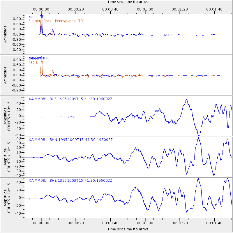
Earthquake location: Near Coast Of Jalisco, Mexico
Earthquake latitude/longitude: 19.1/-104.2
Earthquake time(UTC): 1995/10/09 (282) 15:35:55 GMT
Earthquake Depth: 49 km
Earthquake Magnitude: 6.5 MB, 7.3 MS, 7.3 UNKNOWN, 7.9 MW
Earthquake Catalog/Contributor: WHDF/NEIC
Network: XA Missouri to Massachusetts Transect
Station: MM08 Slippery Rock , Pennsylvania
Lat/Lon: 41.11 N/80.07 W
Elevation: 381 m
Distance: 30.1 deg
Az: 38.093 deg
Baz: 230.519 deg
Ray Param: 0.07936549
Estimated Moho Depth: 65.25 km
Estimated Crust Vp/Vs: 1.62
Assumed Crust Vp: 6.483 km/s
Estimated Crust Vs: 3.989 km/s
Estimated Crust Poisson's Ratio: 0.20
Radial Match: 96.90439 %
Radial Bump: 224
Transverse Match: 78.59243 %
Transverse Bump: 400
SOD ConfigId: 6273
Insert Time: 2010-02-26 17:48:46.366 +0000
GWidth: 2.5
Max Bumps: 400
Tol: 0.001

Signal To Noise

ChannelStoNSTALTA
XA:MM08: :BHN:19951009T15:41:30.196002Z21.1233064.1749213E-61.9764526E-7
XA:MM08: :BHE:19951009T15:41:30.196002Z24.7851375.7921093E-62.3369286E-7
XA:MM08: :BHZ:19951009T15:41:30.196002Z35.989311.04574065E-52.9056977E-7
Arrivals
Ps6.9 SECOND
PpPs24 SECOND
PsPs/PpSs31 SECOND