You are here: Home > Network List > UW - Pacific Northwest Regional Seismic Network Stations List
> Station IRON Crane, OR, USA > Earthquake Result Viewer
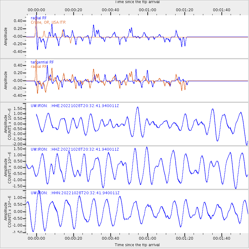
IRON Crane, OR, USA - Earthquake Result Viewer
*The percent match for this event was below the threshold and hence no stack was calculated.
| Earthquake location: |
Near Coast Of Peru |
| Earthquake latitude/longitude: |
-14.5/-76.2 |
| Earthquake time(UTC): |
2022/10/28 (301) 20:22:06 GMT |
| Earthquake Depth: |
16 km |
| Earthquake Magnitude: |
5.9 mww |
| Earthquake Catalog/Contributor: |
NEIC PDE/us |
|
| Network: |
UW Pacific Northwest Regional Seismic Network |
| Station: |
IRON Crane, OR, USA |
| Lat/Lon: |
43.36 N/118.47 W |
| Elevation: |
1226 m |
|
| Distance: |
69.4 deg |
| Az: |
328.358 deg |
| Baz: |
135.848 deg |
| Ray Param: |
$rayparam |
*The percent match for this event was below the threshold and hence was not used in the summary stack. |
|
| Radial Match: |
41.69034 % |
| Radial Bump: |
400 |
| Transverse Match: |
77.02186 % |
| Transverse Bump: |
275 |
| SOD ConfigId: |
29669891 |
| Insert Time: |
2022-11-11 21:46:35.592 +0000 |
| GWidth: |
2.5 |
| Max Bumps: |
400 |
| Tol: |
0.001 |
|
Signal To Noise
| Channel | StoN | STA | LTA |
| UW:IRON: :HHZ:20221028T20:32:41.940011Z | 1.6136247 | 6.625494E-7 | 4.1059698E-7 |
| UW:IRON: :HHN:20221028T20:32:41.940011Z | 2.4827106 | 1.0111123E-6 | 4.0726147E-7 |
| UW:IRON: :HHE:20221028T20:32:41.940011Z | 1.1960338 | 6.1423646E-7 | 5.1356113E-7 |
| Arrivals |
| Ps | |
| PpPs | |
| PsPs/PpSs | |


