You are here: Home > Network List > TA - USArray Transportable Network (new EarthScope stations) Stations List
> Station X20A Quemado, NM, USA > Earthquake Result Viewer
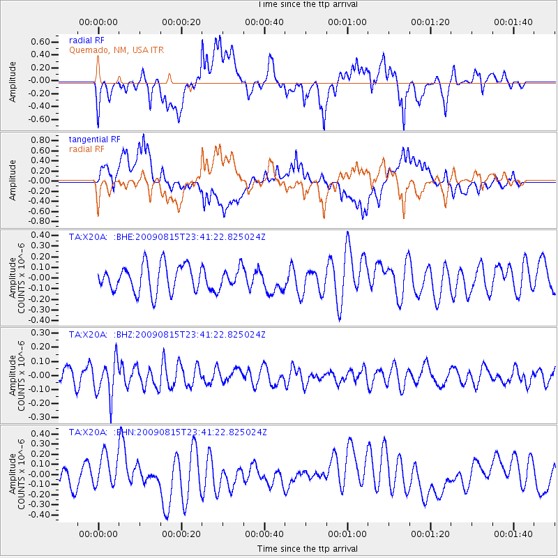
X20A Quemado, NM, USA - Earthquake Result Viewer
*The percent match for this event was below the threshold and hence no stack was calculated.
| Earthquake location: |
Fiji Islands Region |
| Earthquake latitude/longitude: |
-19.8/-178.2 |
| Earthquake time(UTC): |
2009/08/15 (227) 23:30:19 GMT |
| Earthquake Depth: |
608 km |
| Earthquake Magnitude: |
5.6 MW, 5.2 MB |
| Earthquake Catalog/Contributor: |
WHDF/NEIC |
|
| Network: |
TA USArray Transportable Network (new EarthScope stations) |
| Station: |
X20A Quemado, NM, USA |
| Lat/Lon: |
34.54 N/108.50 W |
| Elevation: |
2057 m |
|
| Distance: |
85.5 deg |
| Az: |
50.971 deg |
| Baz: |
242.37 deg |
| Ray Param: |
$rayparam |
*The percent match for this event was below the threshold and hence was not used in the summary stack. |
|
| Radial Match: |
52.423134 % |
| Radial Bump: |
400 |
| Transverse Match: |
49.92633 % |
| Transverse Bump: |
400 |
| SOD ConfigId: |
296778 |
| Insert Time: |
2010-03-30 21:01:21.394 +0000 |
| GWidth: |
2.5 |
| Max Bumps: |
400 |
| Tol: |
0.001 |
|
Signal To Noise
| Channel | StoN | STA | LTA |
| TA:X20A: :BHZ:20090815T23:41:22.825024Z | 2.1681437 | 1.306021E-7 | 6.023683E-8 |
| TA:X20A: :BHN:20090815T23:41:22.825024Z | 1.1095368 | 1.6499116E-7 | 1.4870275E-7 |
| TA:X20A: :BHE:20090815T23:41:22.825024Z | 0.66464907 | 8.528962E-8 | 1.2832278E-7 |
| Arrivals |
| Ps | |
| PpPs | |
| PsPs/PpSs | |


