KMBO Kilima Mbogo, Kenya - Earthquake Result Viewer
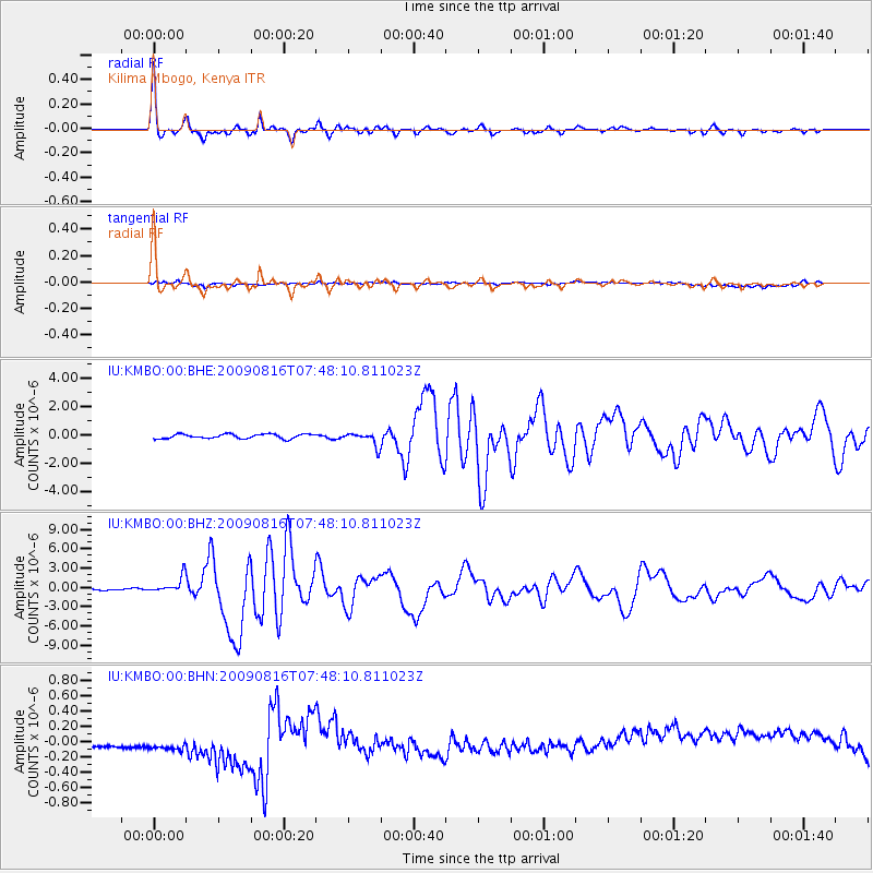
Earthquake location: Southern Sumatra, Indonesia
Earthquake latitude/longitude: -1.5/99.5
Earthquake time(UTC): 2009/08/16 (228) 07:38:21 GMT
Earthquake Depth: 20 km
Earthquake Magnitude: 6.5 MB, 6.7 MS, 6.7 MW, 6.5 MW
Earthquake Catalog/Contributor: WHDF/NEIC
Network: IU Global Seismograph Network (GSN - IRIS/USGS)
Station: KMBO Kilima Mbogo, Kenya
Lat/Lon: 1.13 S/37.25 E
Elevation: 1950 m
Distance: 62.2 deg
Az: 269.508 deg
Baz: 91.071 deg
Ray Param: 0.060347717
Estimated Moho Depth: 41.25 km
Estimated Crust Vp/Vs: 1.75
Assumed Crust Vp: 6.601 km/s
Estimated Crust Vs: 3.772 km/s
Estimated Crust Poisson's Ratio: 0.26
Radial Match: 97.788895 %
Radial Bump: 252
Transverse Match: 37.80464 %
Transverse Bump: 400
SOD ConfigId: 296778
Insert Time: 2010-03-30 21:04:20.870 +0000
GWidth: 2.5
Max Bumps: 400
Tol: 0.001

Signal To Noise

ChannelStoNSTALTA
IU:KMBO:00:BHZ:20090816T07:48:10.811023Z9.8047531.2455296E-61.2703325E-7
IU:KMBO:00:BHN:20090816T07:48:10.811023Z0.960021263.2217895E-73.3559564E-7
IU:KMBO:00:BHE:20090816T07:48:10.811023Z3.11598134.8720756E-71.5635766E-7
Arrivals
Ps4.9 SECOND
PpPs16 SECOND
PsPs/PpSs21 SECOND