You are here: Home > Network List > GS - US Geological Survey Networks Stations List
> Station KAN10 Keim Farm > Earthquake Result Viewer
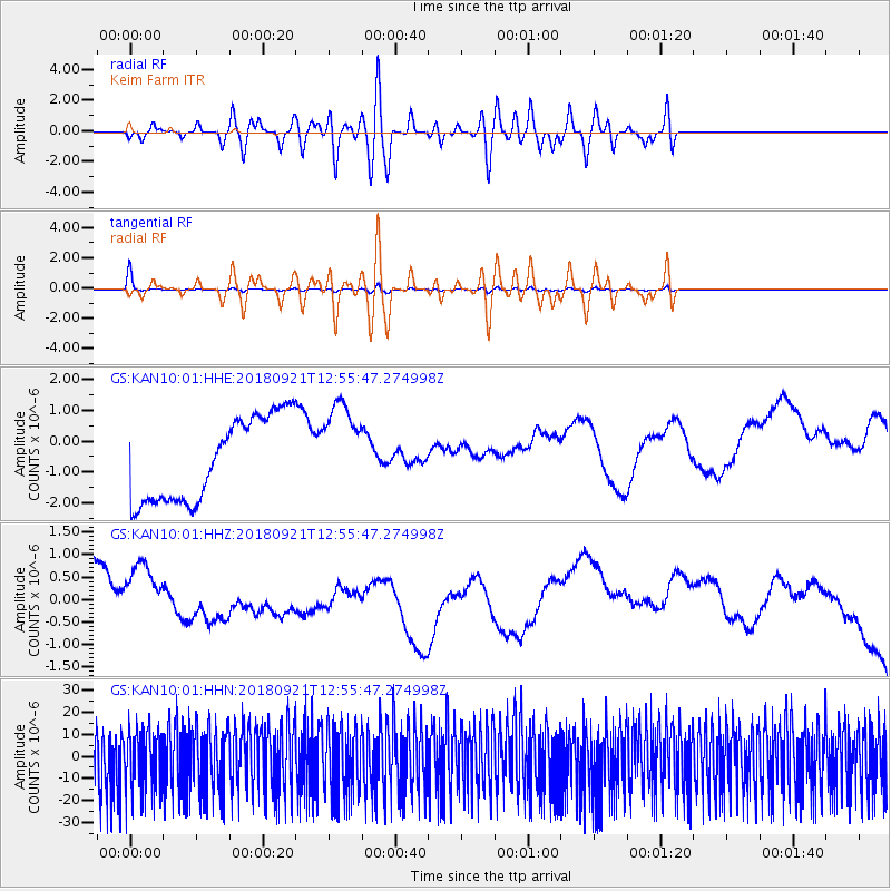
KAN10 Keim Farm - Earthquake Result Viewer
*The percent match for this event was below the threshold and hence no stack was calculated.
| Earthquake location: |
Galapagos Islands Region |
| Earthquake latitude/longitude: |
2.4/-95.5 |
| Earthquake time(UTC): |
2018/09/21 (264) 12:49:28 GMT |
| Earthquake Depth: |
10 km |
| Earthquake Magnitude: |
5.7 Mww |
| Earthquake Catalog/Contributor: |
NEIC PDE/us |
|
| Network: |
GS US Geological Survey Networks |
| Station: |
KAN10 Keim Farm |
| Lat/Lon: |
37.12 N/98.10 W |
| Elevation: |
417 m |
|
| Distance: |
34.6 deg |
| Az: |
356.318 deg |
| Baz: |
175.395 deg |
| Ray Param: |
$rayparam |
*The percent match for this event was below the threshold and hence was not used in the summary stack. |
|
| Radial Match: |
32.16308 % |
| Radial Bump: |
400 |
| Transverse Match: |
92.875694 % |
| Transverse Bump: |
372 |
| SOD ConfigId: |
2963291 |
| Insert Time: |
2018-10-05 12:57:34.225 +0000 |
| GWidth: |
2.5 |
| Max Bumps: |
400 |
| Tol: |
0.001 |
|
Signal To Noise
| Channel | StoN | STA | LTA |
| GS:KAN10:01:HHZ:20180921T12:55:47.274998Z | 1.0944752 | 1.0370941E-6 | 9.47572E-7 |
| GS:KAN10:01:HHN:20180921T12:55:47.274998Z | 0.92999834 | 1.4183664E-5 | 1.52512785E-5 |
| GS:KAN10:01:HHE:20180921T12:55:47.274998Z | 1.1289183 | 1.5282103E-6 | 1.3536943E-6 |
| Arrivals |
| Ps | |
| PpPs | |
| PsPs/PpSs | |


