You are here: Home > Network List > US - United States National Seismic Network Stations List
> Station MSO Missoula, Montana, USA > Earthquake Result Viewer
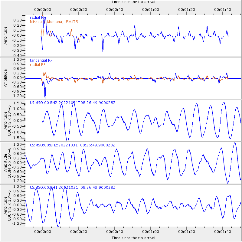
MSO Missoula, Montana, USA - Earthquake Result Viewer
*The percent match for this event was below the threshold and hence no stack was calculated.
| Earthquake location: |
West Chile Rise |
| Earthquake latitude/longitude: |
-38.8/-91.9 |
| Earthquake time(UTC): |
2022/10/31 (304) 08:14:33 GMT |
| Earthquake Depth: |
10 km |
| Earthquake Magnitude: |
5.8 mww |
| Earthquake Catalog/Contributor: |
NEIC PDE/us |
|
| Network: |
US United States National Seismic Network |
| Station: |
MSO Missoula, Montana, USA |
| Lat/Lon: |
46.83 N/113.94 W |
| Elevation: |
1264 m |
|
| Distance: |
87.5 deg |
| Az: |
345.023 deg |
| Baz: |
162.886 deg |
| Ray Param: |
$rayparam |
*The percent match for this event was below the threshold and hence was not used in the summary stack. |
|
| Radial Match: |
67.10369 % |
| Radial Bump: |
400 |
| Transverse Match: |
87.30239 % |
| Transverse Bump: |
345 |
| SOD ConfigId: |
29669891 |
| Insert Time: |
2022-11-14 09:35:29.236 +0000 |
| GWidth: |
2.5 |
| Max Bumps: |
400 |
| Tol: |
0.001 |
|
Signal To Noise
| Channel | StoN | STA | LTA |
| US:MSO:00:BHZ:20221031T08:26:49.900028Z | 0.5732739 | 4.0788638E-7 | 7.115035E-7 |
| US:MSO:00:BH1:20221031T08:26:49.900028Z | 1.7766554 | 8.0856984E-7 | 4.5510785E-7 |
| US:MSO:00:BH2:20221031T08:26:49.900028Z | 0.80967873 | 7.3679826E-7 | 9.0998833E-7 |
| Arrivals |
| Ps | |
| PpPs | |
| PsPs/PpSs | |


