MM08 Slippery Rock , Pennsylvania - Earthquake Result Viewer
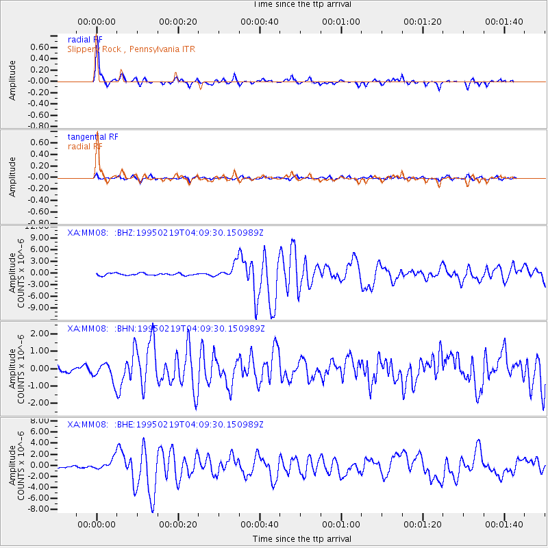
Earthquake location: Off Coast Of Northern California
Earthquake latitude/longitude: 40.6/-125.5
Earthquake time(UTC): 1995/02/19 (050) 04:03:16 GMT
Earthquake Depth: 10 km
Earthquake Magnitude: 6.1 MB, 6.8 MS, 6.7 UNKNOWN, 6.6 MD
Earthquake Catalog/Contributor: WHDF/NEIC
Network: XA Missouri to Massachusetts Transect
Station: MM08 Slippery Rock , Pennsylvania
Lat/Lon: 41.11 N/80.07 W
Elevation: 381 m
Distance: 34.1 deg
Az: 73.874 deg
Baz: 284.399 deg
Ray Param: 0.0779028
Estimated Moho Depth: 50.25 km
Estimated Crust Vp/Vs: 1.74
Assumed Crust Vp: 6.483 km/s
Estimated Crust Vs: 3.726 km/s
Estimated Crust Poisson's Ratio: 0.25
Radial Match: 92.75253 %
Radial Bump: 294
Transverse Match: 83.44044 %
Transverse Bump: 400
SOD ConfigId: 6273
Insert Time: 2010-02-26 17:49:09.322 +0000
GWidth: 2.5
Max Bumps: 400
Tol: 0.001

Signal To Noise

ChannelStoNSTALTA
XA:MM08: :BHN:19950219T04:09:30.150989Z2.8665625.4697955E-71.908138E-7
XA:MM08: :BHE:19950219T04:09:30.150989Z4.18220041.1036147E-62.6388378E-7
XA:MM08: :BHZ:19950219T04:09:30.150989Z7.0598411.9487743E-62.7603656E-7
Arrivals
Ps6.2 SECOND
PpPs20 SECOND
PsPs/PpSs26 SECOND