You are here: Home > Network List > US - United States National Seismic Network Stations List
> Station DGMT Dagmar, Montana, USA > Earthquake Result Viewer
DGMT Dagmar, Montana, USA - Earthquake Result Viewer
*The percent match for this event was below the threshold and hence no stack was calculated.
| Earthquake location: |
Galapagos Islands Region |
| Earthquake latitude/longitude: |
2.4/-95.5 |
| Earthquake time(UTC): |
2018/09/21 (264) 12:49:28 GMT |
| Earthquake Depth: |
10 km |
| Earthquake Magnitude: |
5.7 Mww |
| Earthquake Catalog/Contributor: |
NEIC PDE/us |
|
| Network: |
US United States National Seismic Network |
| Station: |
DGMT Dagmar, Montana, USA |
| Lat/Lon: |
48.47 N/104.20 W |
| Elevation: |
0.0 m |
|
| Distance: |
46.5 deg |
| Az: |
352.006 deg |
| Baz: |
167.949 deg |
| Ray Param: |
$rayparam |
*The percent match for this event was below the threshold and hence was not used in the summary stack. |
|
| Radial Match: |
42.726906 % |
| Radial Bump: |
295 |
| Transverse Match: |
42.374508 % |
| Transverse Bump: |
294 |
| SOD ConfigId: |
2963291 |
| Insert Time: |
2018-10-05 13:00:33.276 +0000 |
| GWidth: |
2.5 |
| Max Bumps: |
400 |
| Tol: |
0.001 |
|
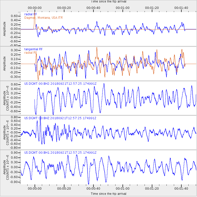
Signal To Noise
| Channel | StoN | STA | LTA |
| US:DGMT:00:BHZ:20180921T12:57:25.174991Z | 2.7402763 | 3.7530268E-7 | 1.3695796E-7 |
| US:DGMT:00:BH1:20180921T12:57:25.174991Z | 1.1807797 | 3.0700866E-7 | 2.6000504E-7 |
| US:DGMT:00:BH2:20180921T12:57:25.174991Z | 0.82077706 | 2.768815E-7 | 3.3734068E-7 |
| Arrivals |
| Ps | |
| PpPs | |
| PsPs/PpSs | |


