You are here: Home > Network List > US - United States National Seismic Network Stations List
> Station HAWA Hanford, Washington, USA > Earthquake Result Viewer
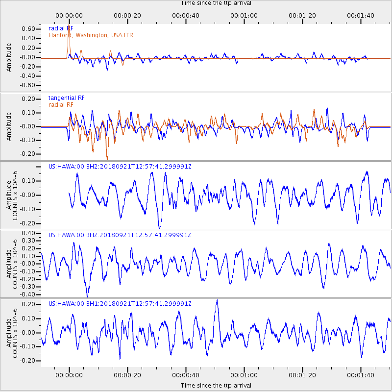
HAWA Hanford, Washington, USA - Earthquake Result Viewer
*The percent match for this event was below the threshold and hence no stack was calculated.
| Earthquake location: |
Galapagos Islands Region |
| Earthquake latitude/longitude: |
2.4/-95.5 |
| Earthquake time(UTC): |
2018/09/21 (264) 12:49:28 GMT |
| Earthquake Depth: |
10 km |
| Earthquake Magnitude: |
5.7 Mww |
| Earthquake Catalog/Contributor: |
NEIC PDE/us |
|
| Network: |
US United States National Seismic Network |
| Station: |
HAWA Hanford, Washington, USA |
| Lat/Lon: |
46.39 N/119.53 W |
| Elevation: |
364 m |
|
| Distance: |
48.6 deg |
| Az: |
337.897 deg |
| Baz: |
147.101 deg |
| Ray Param: |
$rayparam |
*The percent match for this event was below the threshold and hence was not used in the summary stack. |
|
| Radial Match: |
48.788574 % |
| Radial Bump: |
400 |
| Transverse Match: |
55.869095 % |
| Transverse Bump: |
400 |
| SOD ConfigId: |
2963291 |
| Insert Time: |
2018-10-05 13:00:43.571 +0000 |
| GWidth: |
2.5 |
| Max Bumps: |
400 |
| Tol: |
0.001 |
|
Signal To Noise
| Channel | StoN | STA | LTA |
| US:HAWA:00:BHZ:20180921T12:57:41.299991Z | 1.592923 | 1.429905E-7 | 8.9766104E-8 |
| US:HAWA:00:BH1:20180921T12:57:41.299991Z | 1.0230914 | 7.189026E-8 | 7.0267674E-8 |
| US:HAWA:00:BH2:20180921T12:57:41.299991Z | 1.8920624 | 1.20532E-7 | 6.370403E-8 |
| Arrivals |
| Ps | |
| PpPs | |
| PsPs/PpSs | |


