You are here: Home > Network List > US - United States National Seismic Network Stations List
> Station MSO Missoula, Montana, USA > Earthquake Result Viewer
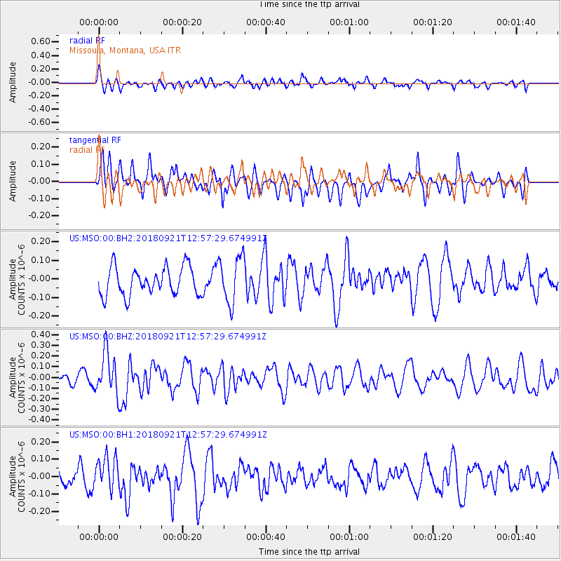
MSO Missoula, Montana, USA - Earthquake Result Viewer
*The percent match for this event was below the threshold and hence no stack was calculated.
| Earthquake location: |
Galapagos Islands Region |
| Earthquake latitude/longitude: |
2.4/-95.5 |
| Earthquake time(UTC): |
2018/09/21 (264) 12:49:28 GMT |
| Earthquake Depth: |
10 km |
| Earthquake Magnitude: |
5.7 Mww |
| Earthquake Catalog/Contributor: |
NEIC PDE/us |
|
| Network: |
US United States National Seismic Network |
| Station: |
MSO Missoula, Montana, USA |
| Lat/Lon: |
46.83 N/113.94 W |
| Elevation: |
1264 m |
|
| Distance: |
47.1 deg |
| Az: |
342.724 deg |
| Baz: |
154.396 deg |
| Ray Param: |
$rayparam |
*The percent match for this event was below the threshold and hence was not used in the summary stack. |
|
| Radial Match: |
44.617348 % |
| Radial Bump: |
400 |
| Transverse Match: |
49.655293 % |
| Transverse Bump: |
400 |
| SOD ConfigId: |
2963291 |
| Insert Time: |
2018-10-05 13:01:03.195 +0000 |
| GWidth: |
2.5 |
| Max Bumps: |
400 |
| Tol: |
0.001 |
|
Signal To Noise
| Channel | StoN | STA | LTA |
| US:MSO:00:BHZ:20180921T12:57:29.674991Z | 3.0041757 | 2.0109186E-7 | 6.693745E-8 |
| US:MSO:00:BH1:20180921T12:57:29.674991Z | 1.4047335 | 9.459928E-8 | 6.734322E-8 |
| US:MSO:00:BH2:20180921T12:57:29.674991Z | 1.6927534 | 1.2756182E-7 | 7.53576E-8 |
| Arrivals |
| Ps | |
| PpPs | |
| PsPs/PpSs | |


