MM08 Slippery Rock , Pennsylvania - Earthquake Result Viewer
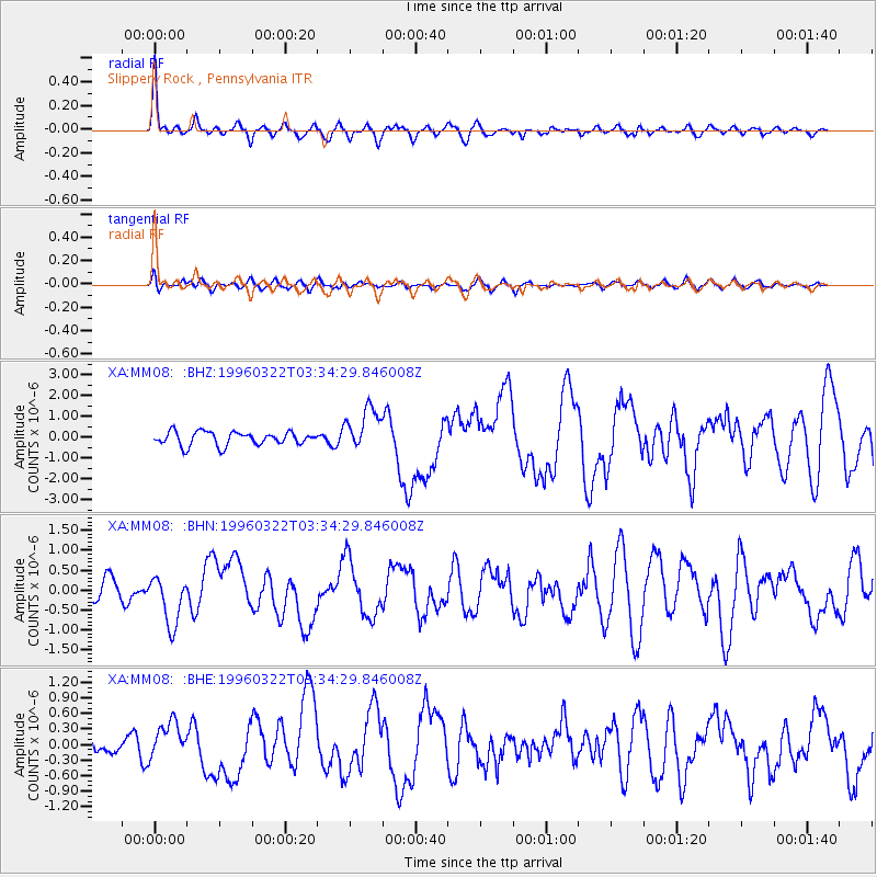
Earthquake location: Rat Islands, Aleutian Islands
Earthquake latitude/longitude: 51.2/178.7
Earthquake time(UTC): 1996/03/22 (082) 03:24:20 GMT
Earthquake Depth: 20 km
Earthquake Magnitude: 5.7 MB, 6.6 MS, 6.8 UNKNOWN, 6.6 ML
Earthquake Catalog/Contributor: WHDF/NEIC
Network: XA Missouri to Massachusetts Transect
Station: MM08 Slippery Rock , Pennsylvania
Lat/Lon: 41.11 N/80.07 W
Elevation: 381 m
Distance: 65.4 deg
Az: 54.616 deg
Baz: 317.272 deg
Ray Param: 0.058291238
Estimated Moho Depth: 47.25 km
Estimated Crust Vp/Vs: 1.84
Assumed Crust Vp: 6.483 km/s
Estimated Crust Vs: 3.518 km/s
Estimated Crust Poisson's Ratio: 0.29
Radial Match: 86.734726 %
Radial Bump: 400
Transverse Match: 60.61383 %
Transverse Bump: 400
SOD ConfigId: 6273
Insert Time: 2010-02-26 17:49:29.990 +0000
GWidth: 2.5
Max Bumps: 400
Tol: 0.001

Signal To Noise

ChannelStoNSTALTA
XA:MM08: :BHN:19960322T03:34:29.846008Z2.66551786.1596376E-72.3108598E-7
XA:MM08: :BHE:19960322T03:34:29.846008Z2.2194933.4600976E-71.5589586E-7
XA:MM08: :BHZ:19960322T03:34:29.846008Z3.15342831.0229281E-63.2438604E-7
Arrivals
Ps6.4 SECOND
PpPs20 SECOND
PsPs/PpSs26 SECOND