You are here: Home > Network List > TA - USArray Transportable Network (new EarthScope stations) Stations List
> Station 331A San Angelo, TX, USA > Earthquake Result Viewer
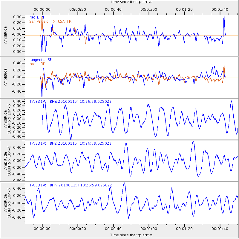
331A San Angelo, TX, USA - Earthquake Result Viewer
*The percent match for this event was below the threshold and hence no stack was calculated.
| Earthquake location: |
Kermadec Islands Region |
| Earthquake latitude/longitude: |
-31.7/-177.6 |
| Earthquake time(UTC): |
2010/01/15 (015) 10:14:02 GMT |
| Earthquake Depth: |
10 km |
| Earthquake Magnitude: |
5.9 MS, 5.4 MB, 5.9 MW |
| Earthquake Catalog/Contributor: |
WHDF/NEIC |
|
| Network: |
TA USArray Transportable Network (new EarthScope stations) |
| Station: |
331A San Angelo, TX, USA |
| Lat/Lon: |
31.31 N/100.43 W |
| Elevation: |
615 m |
|
| Distance: |
96.2 deg |
| Az: |
57.097 deg |
| Baz: |
236.707 deg |
| Ray Param: |
$rayparam |
*The percent match for this event was below the threshold and hence was not used in the summary stack. |
|
| Radial Match: |
46.00136 % |
| Radial Bump: |
400 |
| Transverse Match: |
41.174816 % |
| Transverse Bump: |
400 |
| SOD ConfigId: |
296938 |
| Insert Time: |
2010-04-06 20:00:46.646 +0000 |
| GWidth: |
2.5 |
| Max Bumps: |
400 |
| Tol: |
0.001 |
|
Signal To Noise
| Channel | StoN | STA | LTA |
| TA:331A: :BHZ:20100115T10:26:59.62502Z | 0.6197387 | 1.298724E-7 | 2.0955993E-7 |
| TA:331A: :BHN:20100115T10:26:59.62502Z | 0.5301046 | 1.297344E-7 | 2.447336E-7 |
| TA:331A: :BHE:20100115T10:26:59.62502Z | 0.5785753 | 1.18310744E-7 | 2.0448633E-7 |
| Arrivals |
| Ps | |
| PpPs | |
| PsPs/PpSs | |


