You are here: Home > Network List > TA - USArray Transportable Network (new EarthScope stations) Stations List
> Station 332A Millersview, TX, USA > Earthquake Result Viewer
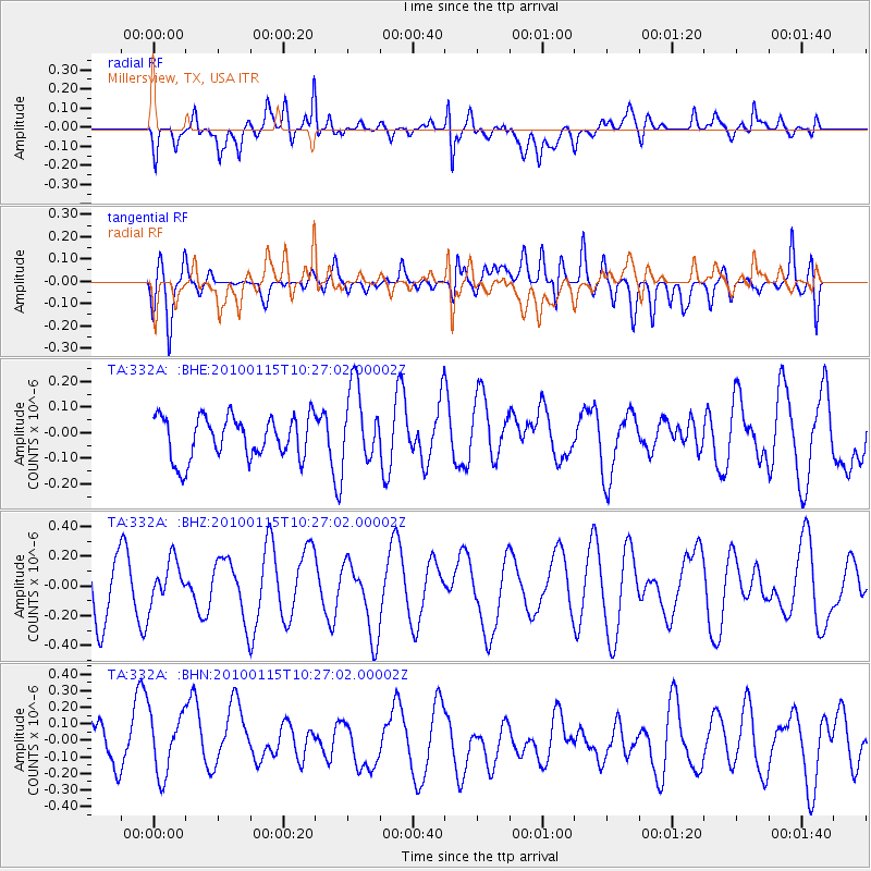
332A Millersview, TX, USA - Earthquake Result Viewer
*The percent match for this event was below the threshold and hence no stack was calculated.
| Earthquake location: |
Kermadec Islands Region |
| Earthquake latitude/longitude: |
-31.7/-177.6 |
| Earthquake time(UTC): |
2010/01/15 (015) 10:14:02 GMT |
| Earthquake Depth: |
10 km |
| Earthquake Magnitude: |
5.9 MS, 5.4 MB, 5.9 MW |
| Earthquake Catalog/Contributor: |
WHDF/NEIC |
|
| Network: |
TA USArray Transportable Network (new EarthScope stations) |
| Station: |
332A Millersview, TX, USA |
| Lat/Lon: |
31.38 N/99.74 W |
| Elevation: |
513 m |
|
| Distance: |
96.8 deg |
| Az: |
57.357 deg |
| Baz: |
237.031 deg |
| Ray Param: |
$rayparam |
*The percent match for this event was below the threshold and hence was not used in the summary stack. |
|
| Radial Match: |
56.32203 % |
| Radial Bump: |
400 |
| Transverse Match: |
38.76304 % |
| Transverse Bump: |
400 |
| SOD ConfigId: |
296938 |
| Insert Time: |
2010-04-06 20:00:47.008 +0000 |
| GWidth: |
2.5 |
| Max Bumps: |
400 |
| Tol: |
0.001 |
|
Signal To Noise
| Channel | StoN | STA | LTA |
| TA:332A: :BHZ:20100115T10:27:02.00002Z | 0.72067577 | 1.4462239E-7 | 2.0067607E-7 |
| TA:332A: :BHN:20100115T10:27:02.00002Z | 1.4090745 | 1.9498495E-7 | 1.3837803E-7 |
| TA:332A: :BHE:20100115T10:27:02.00002Z | 1.8258868 | 1.5030743E-7 | 8.2320234E-8 |
| Arrivals |
| Ps | |
| PpPs | |
| PsPs/PpSs | |


