You are here: Home > Network List > US - United States National Seismic Network Stations List
> Station BOZ Bozeman, Montana, USA > Earthquake Result Viewer
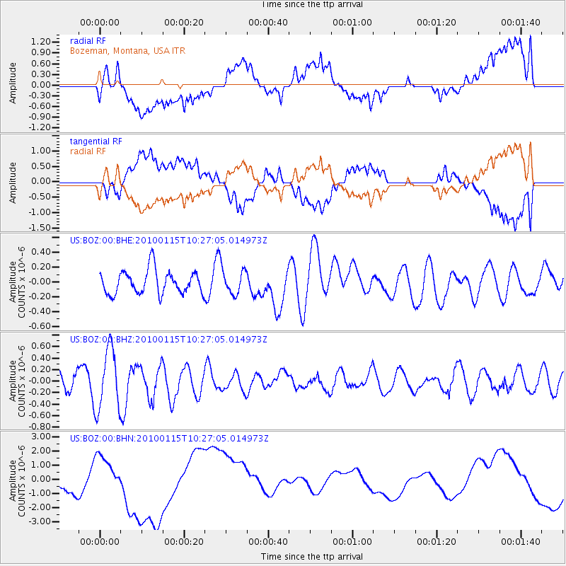
BOZ Bozeman, Montana, USA - Earthquake Result Viewer
*The percent match for this event was below the threshold and hence no stack was calculated.
| Earthquake location: |
Kermadec Islands Region |
| Earthquake latitude/longitude: |
-31.7/-177.6 |
| Earthquake time(UTC): |
2010/01/15 (015) 10:14:02 GMT |
| Earthquake Depth: |
10 km |
| Earthquake Magnitude: |
5.9 MS, 5.4 MB, 5.9 MW |
| Earthquake Catalog/Contributor: |
WHDF/NEIC |
|
| Network: |
US United States National Seismic Network |
| Station: |
BOZ Bozeman, Montana, USA |
| Lat/Lon: |
45.65 N/111.63 W |
| Elevation: |
1589 m |
|
| Distance: |
97.5 deg |
| Az: |
40.256 deg |
| Baz: |
231.719 deg |
| Ray Param: |
$rayparam |
*The percent match for this event was below the threshold and hence was not used in the summary stack. |
|
| Radial Match: |
28.83048 % |
| Radial Bump: |
400 |
| Transverse Match: |
27.839373 % |
| Transverse Bump: |
400 |
| SOD ConfigId: |
296938 |
| Insert Time: |
2010-04-06 20:01:43.592 +0000 |
| GWidth: |
2.5 |
| Max Bumps: |
400 |
| Tol: |
0.001 |
|
Signal To Noise
| Channel | StoN | STA | LTA |
| US:BOZ:00:BHZ:20100115T10:27:05.014973Z | 2.6821342 | 5.3168543E-7 | 1.9823221E-7 |
| US:BOZ:00:BHN:20100115T10:27:05.014973Z | 1.227172 | 1.1108275E-6 | 9.0519296E-7 |
| US:BOZ:00:BHE:20100115T10:27:05.014973Z | 0.9521806 | 1.5029921E-7 | 1.5784738E-7 |
| Arrivals |
| Ps | |
| PpPs | |
| PsPs/PpSs | |


