You are here: Home > Network List > IU - Global Seismograph Network (GSN - IRIS/USGS) Stations List
> Station KMBO Kilima Mbogo, Kenya > Earthquake Result Viewer
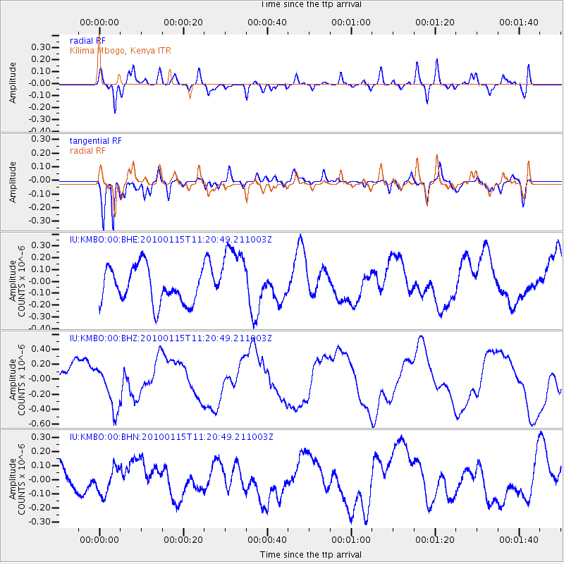
KMBO Kilima Mbogo, Kenya - Earthquake Result Viewer
*The percent match for this event was below the threshold and hence no stack was calculated.
| Earthquake location: |
Ryukyu Islands, Japan |
| Earthquake latitude/longitude: |
26.7/126.3 |
| Earthquake time(UTC): |
2010/01/15 (015) 11:08:38 GMT |
| Earthquake Depth: |
139 km |
| Earthquake Magnitude: |
5.7 MW, 5.4 MB, 5.7 MW |
| Earthquake Catalog/Contributor: |
WHDF/NEIC |
|
| Network: |
IU Global Seismograph Network (GSN - IRIS/USGS) |
| Station: |
KMBO Kilima Mbogo, Kenya |
| Lat/Lon: |
1.13 S/37.25 E |
| Elevation: |
1950 m |
|
| Distance: |
89.6 deg |
| Az: |
268.566 deg |
| Baz: |
63.394 deg |
| Ray Param: |
$rayparam |
*The percent match for this event was below the threshold and hence was not used in the summary stack. |
|
| Radial Match: |
69.650696 % |
| Radial Bump: |
400 |
| Transverse Match: |
83.567795 % |
| Transverse Bump: |
400 |
| SOD ConfigId: |
296938 |
| Insert Time: |
2010-04-06 20:08:45.445 +0000 |
| GWidth: |
2.5 |
| Max Bumps: |
400 |
| Tol: |
0.001 |
|
Signal To Noise
| Channel | StoN | STA | LTA |
| IU:KMBO:00:BHZ:20100115T11:20:49.211003Z | 1.3086103 | 3.0032422E-7 | 2.294986E-7 |
| IU:KMBO:00:BHN:20100115T11:20:49.211003Z | 0.9945545 | 9.238406E-8 | 9.288989E-8 |
| IU:KMBO:00:BHE:20100115T11:20:49.211003Z | 1.8822775 | 2.7982085E-7 | 1.4866077E-7 |
| Arrivals |
| Ps | |
| PpPs | |
| PsPs/PpSs | |


