You are here: Home > Network List > UW - Pacific Northwest Regional Seismic Network Stations List
> Station UMAT Pilot Rock, OR, USA > Earthquake Result Viewer
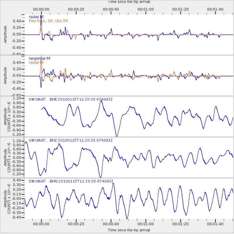
UMAT Pilot Rock, OR, USA - Earthquake Result Viewer
*The percent match for this event was below the threshold and hence no stack was calculated.
| Earthquake location: |
Ryukyu Islands, Japan |
| Earthquake latitude/longitude: |
26.7/126.3 |
| Earthquake time(UTC): |
2010/01/15 (015) 11:08:38 GMT |
| Earthquake Depth: |
139 km |
| Earthquake Magnitude: |
5.7 MW, 5.4 MB, 5.7 MW |
| Earthquake Catalog/Contributor: |
WHDF/NEIC |
|
| Network: |
UW Pacific Northwest Regional Seismic Network |
| Station: |
UMAT Pilot Rock, OR, USA |
| Lat/Lon: |
45.29 N/118.96 W |
| Elevation: |
1318 m |
|
| Distance: |
87.0 deg |
| Az: |
39.935 deg |
| Baz: |
305.593 deg |
| Ray Param: |
$rayparam |
*The percent match for this event was below the threshold and hence was not used in the summary stack. |
|
| Radial Match: |
72.41871 % |
| Radial Bump: |
400 |
| Transverse Match: |
86.06167 % |
| Transverse Bump: |
400 |
| SOD ConfigId: |
296938 |
| Insert Time: |
2010-04-06 20:13:24.010 +0000 |
| GWidth: |
2.5 |
| Max Bumps: |
400 |
| Tol: |
0.001 |
|
Signal To Noise
| Channel | StoN | STA | LTA |
| UW:UMAT: :BHZ:20100115T11:20:36.674993Z | 1.8400365 | 9.514119E-7 | 5.1706144E-7 |
| UW:UMAT: :BHN:20100115T11:20:36.674993Z | 0.9151093 | 1.909002E-7 | 2.0860917E-7 |
| UW:UMAT: :BHE:20100115T11:20:36.674993Z | 1.2039267 | 5.329401E-7 | 4.4266818E-7 |
| Arrivals |
| Ps | |
| PpPs | |
| PsPs/PpSs | |


