You are here: Home > Network List > US - United States National Seismic Network Stations List
> Station AMTX Amarillo, Texas, USA > Earthquake Result Viewer
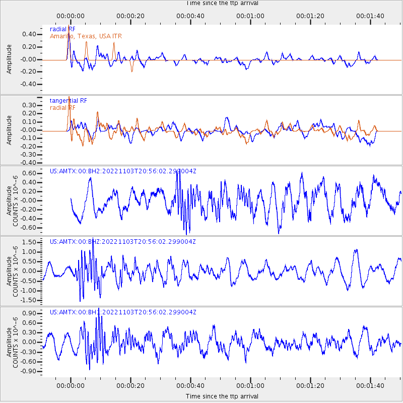
AMTX Amarillo, Texas, USA - Earthquake Result Viewer
*The percent match for this event was below the threshold and hence no stack was calculated.
| Earthquake location: |
Reykjanes Ridge |
| Earthquake latitude/longitude: |
53.8/-35.5 |
| Earthquake time(UTC): |
2022/11/03 (307) 20:47:46 GMT |
| Earthquake Depth: |
10 km |
| Earthquake Magnitude: |
5.4 Mww |
| Earthquake Catalog/Contributor: |
NEIC PDE/us |
|
| Network: |
US United States National Seismic Network |
| Station: |
AMTX Amarillo, Texas, USA |
| Lat/Lon: |
34.53 N/101.41 W |
| Elevation: |
1010 m |
|
| Distance: |
49.1 deg |
| Az: |
274.805 deg |
| Baz: |
45.736 deg |
| Ray Param: |
$rayparam |
*The percent match for this event was below the threshold and hence was not used in the summary stack. |
|
| Radial Match: |
67.990524 % |
| Radial Bump: |
400 |
| Transverse Match: |
41.530518 % |
| Transverse Bump: |
400 |
| SOD ConfigId: |
29669891 |
| Insert Time: |
2022-11-17 22:17:54.333 +0000 |
| GWidth: |
2.5 |
| Max Bumps: |
400 |
| Tol: |
0.001 |
|
Signal To Noise
| Channel | StoN | STA | LTA |
| US:AMTX:00:BHZ:20221103T20:56:02.299004Z | 2.245556 | 5.8395E-7 | 2.6004696E-7 |
| US:AMTX:00:BH1:20221103T20:56:02.299004Z | 1.6812016 | 3.084205E-7 | 1.8345243E-7 |
| US:AMTX:00:BH2:20221103T20:56:02.299004Z | 1.0835642 | 2.4549692E-7 | 2.2656427E-7 |
| Arrivals |
| Ps | |
| PpPs | |
| PsPs/PpSs | |


