You are here: Home > Network List > KN - Kyrgyz Seismic Telemetry Network Stations List
> Station KZA KN.KZA > Earthquake Result Viewer
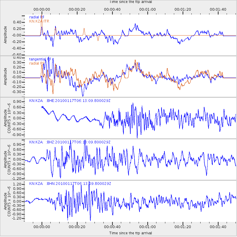
KZA KN.KZA - Earthquake Result Viewer
*The percent match for this event was below the threshold and hence no stack was calculated.
| Earthquake location: |
Off East Coast Of Honshu, Japan |
| Earthquake latitude/longitude: |
37.9/143.6 |
| Earthquake time(UTC): |
2010/01/17 (017) 06:04:36 GMT |
| Earthquake Depth: |
7.0 km |
| Earthquake Magnitude: |
5.7 MB, 5.2 MS, 5.6 MW, 5.6 MW |
| Earthquake Catalog/Contributor: |
WHDF/NEIC |
|
| Network: |
KN Kyrgyz Seismic Telemetry Network |
| Station: |
KZA KN.KZA |
| Lat/Lon: |
42.08 N/75.25 E |
| Elevation: |
3520 m |
|
| Distance: |
51.2 deg |
| Az: |
297.469 deg |
| Baz: |
70.445 deg |
| Ray Param: |
$rayparam |
*The percent match for this event was below the threshold and hence was not used in the summary stack. |
|
| Radial Match: |
65.045235 % |
| Radial Bump: |
400 |
| Transverse Match: |
52.407566 % |
| Transverse Bump: |
400 |
| SOD ConfigId: |
296938 |
| Insert Time: |
2010-04-06 20:22:20.151 +0000 |
| GWidth: |
2.5 |
| Max Bumps: |
400 |
| Tol: |
0.001 |
|
Signal To Noise
| Channel | StoN | STA | LTA |
| KN:KZA: :BHZ:20100117T06:13:09.800029Z | 3.863394 | 2.4975637E-7 | 6.464688E-8 |
| KN:KZA: :BHN:20100117T06:13:09.800029Z | 2.629995 | 2.6658E-7 | 1.013614E-7 |
| KN:KZA: :BHE:20100117T06:13:09.800029Z | 1.6869551 | 3.4903883E-7 | 2.0690464E-7 |
| Arrivals |
| Ps | |
| PpPs | |
| PsPs/PpSs | |


