You are here: Home > Network List > G - GEOSCOPE Stations List
> Station MPG Montagne des Peres, French Guyana > Earthquake Result Viewer
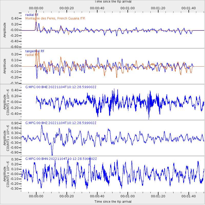
MPG Montagne des Peres, French Guyana - Earthquake Result Viewer
*The percent match for this event was below the threshold and hence no stack was calculated.
| Earthquake location: |
Gulf Of California |
| Earthquake latitude/longitude: |
28.2/-112.3 |
| Earthquake time(UTC): |
2022/11/04 (308) 10:02:46 GMT |
| Earthquake Depth: |
10 km |
| Earthquake Magnitude: |
6.1 mww |
| Earthquake Catalog/Contributor: |
NEIC PDE/us |
|
| Network: |
G GEOSCOPE |
| Station: |
MPG Montagne des Peres, French Guyana |
| Lat/Lon: |
5.11 N/52.64 W |
| Elevation: |
147 m |
|
| Distance: |
60.9 deg |
| Az: |
100.429 deg |
| Baz: |
299.348 deg |
| Ray Param: |
$rayparam |
*The percent match for this event was below the threshold and hence was not used in the summary stack. |
|
| Radial Match: |
69.68752 % |
| Radial Bump: |
400 |
| Transverse Match: |
53.950226 % |
| Transverse Bump: |
400 |
| SOD ConfigId: |
29669891 |
| Insert Time: |
2022-11-18 11:11:53.934 +0000 |
| GWidth: |
2.5 |
| Max Bumps: |
400 |
| Tol: |
0.001 |
|
Signal To Noise
| Channel | StoN | STA | LTA |
| G:MPG:00:BHZ:20221104T10:12:28.599002Z | 2.0349162 | 3.177186E-7 | 1.5613351E-7 |
| G:MPG:00:BHN:20221104T10:12:28.599002Z | 1.3125019 | 1.4772955E-7 | 1.1255568E-7 |
| G:MPG:00:BHE:20221104T10:12:28.599002Z | 1.010043 | 1.07273394E-7 | 1.0620676E-7 |
| Arrivals |
| Ps | |
| PpPs | |
| PsPs/PpSs | |


