You are here: Home > Network List > TA - USArray Transportable Network (new EarthScope stations) Stations List
> Station 123A Bell Site, White Sands Missle Range, NM, USA > Earthquake Result Viewer
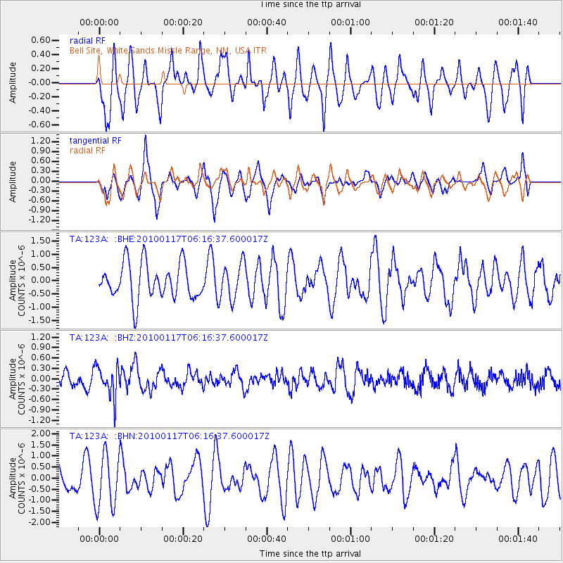
123A Bell Site, White Sands Missle Range, NM, USA - Earthquake Result Viewer
*The percent match for this event was below the threshold and hence no stack was calculated.
| Earthquake location: |
Off East Coast Of Honshu, Japan |
| Earthquake latitude/longitude: |
37.9/143.6 |
| Earthquake time(UTC): |
2010/01/17 (017) 06:04:36 GMT |
| Earthquake Depth: |
7.0 km |
| Earthquake Magnitude: |
5.7 MB, 5.2 MS, 5.6 MW, 5.6 MW |
| Earthquake Catalog/Contributor: |
WHDF/NEIC |
|
| Network: |
TA USArray Transportable Network (new EarthScope stations) |
| Station: |
123A Bell Site, White Sands Missle Range, NM, USA |
| Lat/Lon: |
32.63 N/106.26 W |
| Elevation: |
1206 m |
|
| Distance: |
84.3 deg |
| Az: |
52.757 deg |
| Baz: |
311.756 deg |
| Ray Param: |
$rayparam |
*The percent match for this event was below the threshold and hence was not used in the summary stack. |
|
| Radial Match: |
46.796833 % |
| Radial Bump: |
390 |
| Transverse Match: |
53.424503 % |
| Transverse Bump: |
367 |
| SOD ConfigId: |
296938 |
| Insert Time: |
2010-04-06 20:26:18.550 +0000 |
| GWidth: |
2.5 |
| Max Bumps: |
400 |
| Tol: |
0.001 |
|
Signal To Noise
| Channel | StoN | STA | LTA |
| TA:123A: :BHZ:20100117T06:16:37.600017Z | 2.4111028 | 4.3690207E-7 | 1.8120426E-7 |
| TA:123A: :BHN:20100117T06:16:37.600017Z | 1.6032586 | 1.2262077E-6 | 7.648222E-7 |
| TA:123A: :BHE:20100117T06:16:37.600017Z | 0.98396826 | 6.660895E-7 | 6.76942E-7 |
| Arrivals |
| Ps | |
| PpPs | |
| PsPs/PpSs | |


