You are here: Home > Network List > XA95 - Missouri to Massachusetts Transect Stations List
> Station MM08 Slippery Rock , Pennsylvania > Earthquake Result Viewer
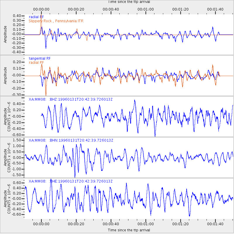
MM08 Slippery Rock , Pennsylvania - Earthquake Result Viewer
*The percent match for this event was below the threshold and hence no stack was calculated.
| Earthquake location: |
Kuril Islands |
| Earthquake latitude/longitude: |
44.5/149.4 |
| Earthquake time(UTC): |
1996/01/31 (031) 20:30:47 GMT |
| Earthquake Depth: |
58 km |
| Earthquake Magnitude: |
5.8 MB, 6.1 UNKNOWN, 5.9 MW |
| Earthquake Catalog/Contributor: |
WHDF/NEIC |
|
| Network: |
XA Missouri to Massachusetts Transect |
| Station: |
MM08 Slippery Rock , Pennsylvania |
| Lat/Lon: |
41.11 N/80.07 W |
| Elevation: |
381 m |
|
| Distance: |
84.0 deg |
| Az: |
35.26 deg |
| Baz: |
326.831 deg |
| Ray Param: |
$rayparam |
*The percent match for this event was below the threshold and hence was not used in the summary stack. |
|
| Radial Match: |
60.222237 % |
| Radial Bump: |
321 |
| Transverse Match: |
47.155777 % |
| Transverse Bump: |
400 |
| SOD ConfigId: |
4480 |
| Insert Time: |
2010-02-26 17:49:51.071 +0000 |
| GWidth: |
2.5 |
| Max Bumps: |
400 |
| Tol: |
0.001 |
|
Signal To Noise
| Channel | StoN | STA | LTA |
| XA:MM08: :BHN:19960131T20:42:39.726013Z | 2.8965762 | 5.04843E-7 | 1.7428955E-7 |
| XA:MM08: :BHE:19960131T20:42:39.726013Z | 0.98032105 | 2.2420693E-7 | 2.2870765E-7 |
| XA:MM08: :BHZ:19960131T20:42:39.726013Z | 0.7824247 | 1.8621715E-7 | 2.3800008E-7 |
| Arrivals |
| Ps | |
| PpPs | |
| PsPs/PpSs | |


