You are here: Home > Network List > US - United States National Seismic Network Stations List
> Station HAWA Hanford, Washington, USA > Earthquake Result Viewer
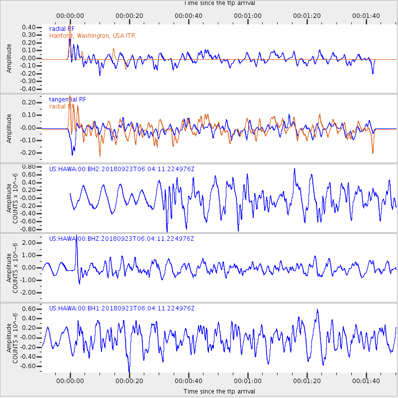
HAWA Hanford, Washington, USA - Earthquake Result Viewer
*The percent match for this event was below the threshold and hence no stack was calculated.
| Earthquake location: |
South Of Mariana Islands |
| Earthquake latitude/longitude: |
12.2/146.2 |
| Earthquake time(UTC): |
2018/09/23 (266) 05:52:11 GMT |
| Earthquake Depth: |
10 km |
| Earthquake Magnitude: |
5.9 Mww |
| Earthquake Catalog/Contributor: |
NEIC PDE/us |
|
| Network: |
US United States National Seismic Network |
| Station: |
HAWA Hanford, Washington, USA |
| Lat/Lon: |
46.39 N/119.53 W |
| Elevation: |
364 m |
|
| Distance: |
84.2 deg |
| Az: |
43.937 deg |
| Baz: |
281.451 deg |
| Ray Param: |
$rayparam |
*The percent match for this event was below the threshold and hence was not used in the summary stack. |
|
| Radial Match: |
55.471867 % |
| Radial Bump: |
400 |
| Transverse Match: |
53.924065 % |
| Transverse Bump: |
400 |
| SOD ConfigId: |
2963291 |
| Insert Time: |
2018-10-07 06:03:43.422 +0000 |
| GWidth: |
2.5 |
| Max Bumps: |
400 |
| Tol: |
0.001 |
|
Signal To Noise
| Channel | StoN | STA | LTA |
| US:HAWA:00:BHZ:20180923T06:04:11.224976Z | 2.6471503 | 8.0474786E-7 | 3.0400537E-7 |
| US:HAWA:00:BH1:20180923T06:04:11.224976Z | 1.5502568 | 2.0830498E-7 | 1.3436805E-7 |
| US:HAWA:00:BH2:20180923T06:04:11.224976Z | 1.8289453 | 3.5874314E-7 | 1.9614755E-7 |
| Arrivals |
| Ps | |
| PpPs | |
| PsPs/PpSs | |


