You are here: Home > Network List > US - United States National Seismic Network Stations List
> Station BOZ Bozeman, Montana, USA > Earthquake Result Viewer
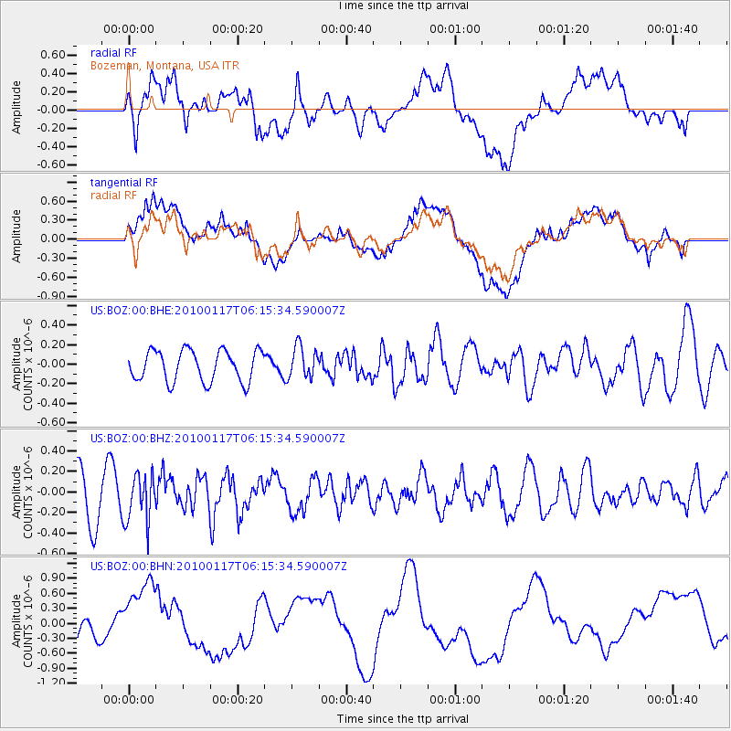
BOZ Bozeman, Montana, USA - Earthquake Result Viewer
*The percent match for this event was below the threshold and hence no stack was calculated.
| Earthquake location: |
Off East Coast Of Honshu, Japan |
| Earthquake latitude/longitude: |
37.9/143.6 |
| Earthquake time(UTC): |
2010/01/17 (017) 06:04:36 GMT |
| Earthquake Depth: |
7.0 km |
| Earthquake Magnitude: |
5.7 MB, 5.2 MS, 5.6 MW, 5.6 MW |
| Earthquake Catalog/Contributor: |
WHDF/NEIC |
|
| Network: |
US United States National Seismic Network |
| Station: |
BOZ Bozeman, Montana, USA |
| Lat/Lon: |
45.65 N/111.63 W |
| Elevation: |
1589 m |
|
| Distance: |
72.8 deg |
| Az: |
45.224 deg |
| Baz: |
306.857 deg |
| Ray Param: |
$rayparam |
*The percent match for this event was below the threshold and hence was not used in the summary stack. |
|
| Radial Match: |
42.61895 % |
| Radial Bump: |
400 |
| Transverse Match: |
33.447067 % |
| Transverse Bump: |
400 |
| SOD ConfigId: |
296938 |
| Insert Time: |
2010-04-06 20:38:24.957 +0000 |
| GWidth: |
2.5 |
| Max Bumps: |
400 |
| Tol: |
0.001 |
|
Signal To Noise
| Channel | StoN | STA | LTA |
| US:BOZ:00:BHZ:20100117T06:15:34.590007Z | 1.1848303 | 2.3077233E-7 | 1.9477247E-7 |
| US:BOZ:00:BHN:20100117T06:15:34.590007Z | 2.317239 | 7.52187E-7 | 3.2460485E-7 |
| US:BOZ:00:BHE:20100117T06:15:34.590007Z | 1.0287563 | 1.6317952E-7 | 1.5861826E-7 |
| Arrivals |
| Ps | |
| PpPs | |
| PsPs/PpSs | |


