
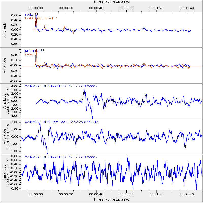
MM09 East Canton, Ohio - Earthquake Result Viewer
| ||||||||||||||||||
| ||||||||||||||||||
| ||||||||||||||||||
|
Signal To Noise
| Channel | StoN | STA | LTA |
| XA:MM09: :BHN:19951003T12:52:29.876001Z | 5.156162 | 8.415711E-7 | 1.6321658E-7 |
| XA:MM09: :BHE:19951003T12:52:29.876001Z | 1.024819 | 2.0866638E-7 | 2.0361291E-7 |
| XA:MM09: :BHZ:19951003T12:52:29.876001Z | 5.104425 | 1.477211E-6 | 2.8939812E-7 |
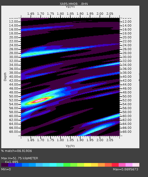
| Arrivals | |
| Ps | 6.0 SECOND |
| PpPs | 20 SECOND |
| PsPs/PpSs | 26 SECOND |

