You are here: Home > Network List > CI - Caltech Regional Seismic Network Stations List
> Station BEL Belle Mtn, Joshua Tree National Park, CA, USA > Earthquake Result Viewer
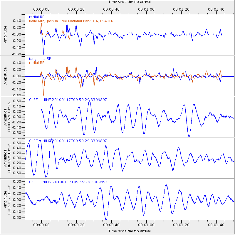
BEL Belle Mtn, Joshua Tree National Park, CA, USA - Earthquake Result Viewer
*The percent match for this event was below the threshold and hence no stack was calculated.
| Earthquake location: |
New Britain Region, P.N.G. |
| Earthquake latitude/longitude: |
-6.1/152.6 |
| Earthquake time(UTC): |
2010/01/17 (017) 09:46:40 GMT |
| Earthquake Depth: |
10 km |
| Earthquake Magnitude: |
5.5 MB, 5.1 MS, 5.7 MW, 5.7 MW |
| Earthquake Catalog/Contributor: |
WHDF/NEIC |
|
| Network: |
CI Caltech Regional Seismic Network |
| Station: |
BEL Belle Mtn, Joshua Tree National Park, CA, USA |
| Lat/Lon: |
34.00 N/116.00 W |
| Elevation: |
1388 m |
|
| Distance: |
94.6 deg |
| Az: |
56.423 deg |
| Baz: |
265.723 deg |
| Ray Param: |
$rayparam |
*The percent match for this event was below the threshold and hence was not used in the summary stack. |
|
| Radial Match: |
61.045086 % |
| Radial Bump: |
400 |
| Transverse Match: |
58.521145 % |
| Transverse Bump: |
370 |
| SOD ConfigId: |
296938 |
| Insert Time: |
2010-04-06 20:41:58.648 +0000 |
| GWidth: |
2.5 |
| Max Bumps: |
400 |
| Tol: |
0.001 |
|
Signal To Noise
| Channel | StoN | STA | LTA |
| CI:BEL: :BHZ:20100117T09:59:29.330989Z | 2.1218493 | 5.352202E-7 | 2.5224233E-7 |
| CI:BEL: :BHN:20100117T09:59:29.330989Z | 0.3364264 | 5.301736E-8 | 1.5758977E-7 |
| CI:BEL: :BHE:20100117T09:59:29.330989Z | 0.9840899 | 2.620275E-7 | 2.6626378E-7 |
| Arrivals |
| Ps | |
| PpPs | |
| PsPs/PpSs | |


