MM09 East Canton, Ohio - Earthquake Result Viewer
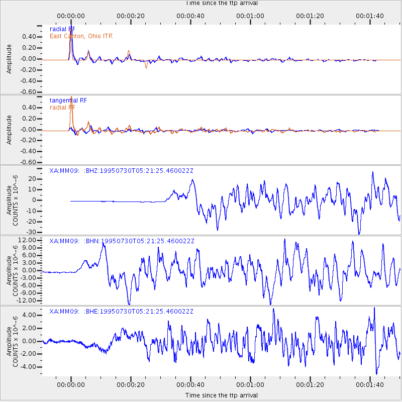
Earthquake location: Near Coast Of Northern Chile
Earthquake latitude/longitude: -23.4/-70.3
Earthquake time(UTC): 1995/07/30 (211) 05:11:23 GMT
Earthquake Depth: 47 km
Earthquake Magnitude: 6.6 MB, 7.3 MS, 7.2 UNKNOWN, 8.1 MW
Earthquake Catalog/Contributor: WHDF/NEIC
Network: XA Missouri to Massachusetts Transect
Station: MM09 East Canton, Ohio
Lat/Lon: 40.79 N/81.21 W
Elevation: 357 m
Distance: 64.6 deg
Az: 350.862 deg
Baz: 168.918 deg
Ray Param: 0.05870773
Estimated Moho Depth: 48.0 km
Estimated Crust Vp/Vs: 1.76
Assumed Crust Vp: 6.483 km/s
Estimated Crust Vs: 3.683 km/s
Estimated Crust Poisson's Ratio: 0.26
Radial Match: 97.49483 %
Radial Bump: 291
Transverse Match: 87.68531 %
Transverse Bump: 400
SOD ConfigId: 6273
Insert Time: 2010-02-26 17:49:55.933 +0000
GWidth: 2.5
Max Bumps: 400
Tol: 0.001

Signal To Noise

ChannelStoNSTALTA
XA:MM09: :BHN:19950730T05:21:25.460022Z11.616361.8856043E-61.6232316E-7
XA:MM09: :BHE:19950730T05:21:25.460022Z2.04665162.7379951E-71.3377925E-7
XA:MM09: :BHZ:19950730T05:21:25.460022Z17.2885064.243756E-62.4546694E-7
Arrivals
Ps5.9 SECOND
PpPs20 SECOND
PsPs/PpSs25 SECOND