MM09 East Canton, Ohio - Earthquake Result Viewer
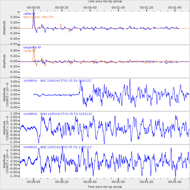
Earthquake location: Rat Islands, Aleutian Islands
Earthquake latitude/longitude: 51.3/179.7
Earthquake time(UTC): 1995/04/23 (113) 02:55:54 GMT
Earthquake Depth: 16 km
Earthquake Magnitude: 6.1 MB, 6.4 MS, 6.5 UNKNOWN, 6.7 ML
Earthquake Catalog/Contributor: WHDF/NEIC
Network: XA Missouri to Massachusetts Transect
Station: MM09 East Canton, Ohio
Lat/Lon: 40.79 N/81.21 W
Elevation: 357 m
Distance: 64.4 deg
Az: 56.219 deg
Baz: 316.633 deg
Ray Param: 0.05891676
Estimated Moho Depth: 33.0 km
Estimated Crust Vp/Vs: 2.10
Assumed Crust Vp: 6.483 km/s
Estimated Crust Vs: 3.091 km/s
Estimated Crust Poisson's Ratio: 0.35
Radial Match: 95.127716 %
Radial Bump: 335
Transverse Match: 64.0005 %
Transverse Bump: 400
SOD ConfigId: 6273
Insert Time: 2010-02-26 17:50:00.295 +0000
GWidth: 2.5
Max Bumps: 400
Tol: 0.001

Signal To Noise

ChannelStoNSTALTA
XA:MM09: :BHN:19950423T03:05:59.126013Z4.93037755.1588466E-71.04633905E-7
XA:MM09: :BHE:19950423T03:05:59.126013Z4.61793384.6237014E-71.0012489E-7
XA:MM09: :BHZ:19950423T03:05:59.126013Z12.0895571.2616772E-61.04360915E-7
Arrivals
Ps5.8 SECOND
PpPs15 SECOND
PsPs/PpSs21 SECOND