
MM09 East Canton, Ohio - Earthquake Result Viewer
| ||||||||||||||||||
| ||||||||||||||||||
| ||||||||||||||||||
|
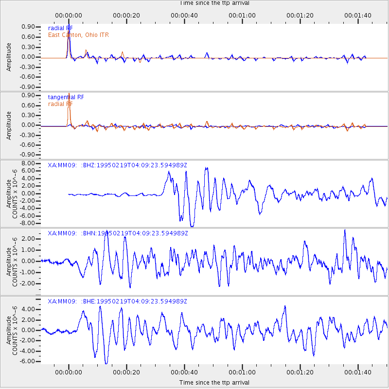
Signal To Noise
| Channel | StoN | STA | LTA |
| XA:MM09: :BHN:19950219T04:09:23.594989Z | 1.7657683 | 5.428955E-7 | 3.0745568E-7 |
| XA:MM09: :BHE:19950219T04:09:23.594989Z | 4.582163 | 1.4134565E-6 | 3.084693E-7 |
| XA:MM09: :BHZ:19950219T04:09:23.594989Z | 11.110836 | 2.4026658E-6 | 2.1624528E-7 |
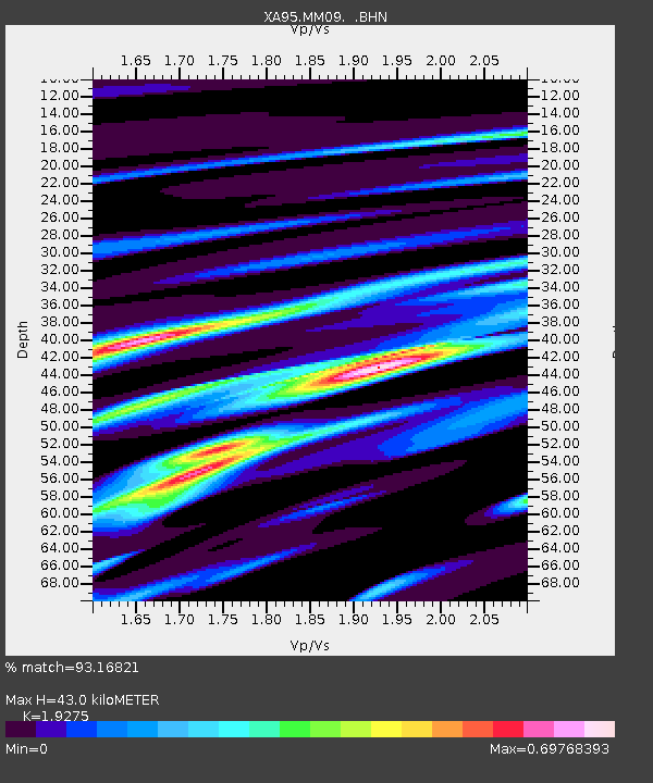
| Arrivals | |
| Ps | 6.6 SECOND |
| PpPs | 18 SECOND |
| PsPs/PpSs | 25 SECOND |

