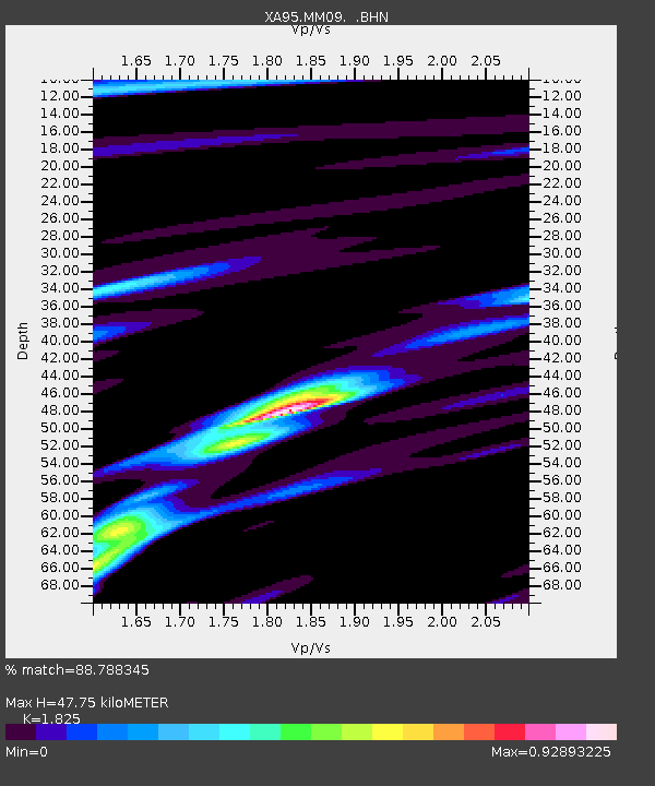
MM09 East Canton, Ohio - Earthquake Result Viewer
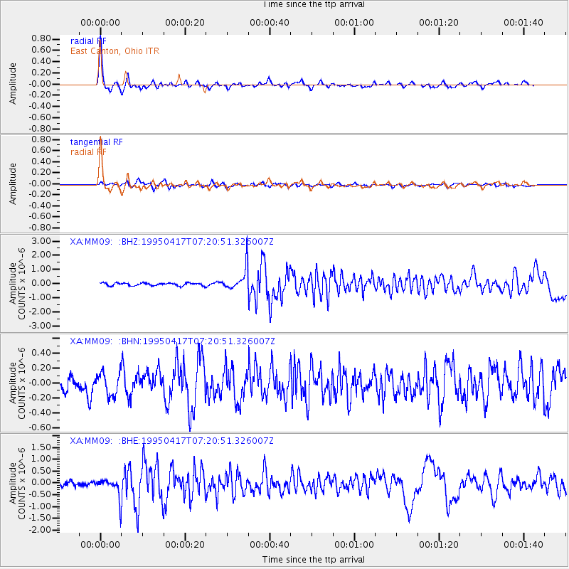
Earthquake location: Northern Mid-Atlantic Ridge
Earthquake latitude/longitude: 33.8/-38.6
Earthquake time(UTC): 1995/04/17 (107) 07:14:35 GMT
Earthquake Depth: 10 km
Earthquake Magnitude: 5.8 MB, 5.8 MS, 5.9 UNKNOWN, 6.1 MW
Earthquake Catalog/Contributor: WHDF/NEIC
Network: XA Missouri to Massachusetts Transect
Station: MM09 East Canton, Ohio
Lat/Lon: 40.79 N/81.21 W
Elevation: 357 m
Distance: 34.3 deg
Az: 294.367 deg
Baz: 87.846 deg
Ray Param: 0.07778741
Estimated Moho Depth: 47.75 km
Estimated Crust Vp/Vs: 1.83
Assumed Crust Vp: 6.483 km/s
Estimated Crust Vs: 3.552 km/s
Estimated Crust Poisson's Ratio: 0.29
Radial Match: 88.788345 %
Radial Bump: 312
Transverse Match: 67.40363 %
Transverse Bump: 400
SOD ConfigId: 6273
Insert Time: 2010-02-26 17:50:05.664 +0000
GWidth: 2.5
Max Bumps: 400
Tol: 0.001

Signal To Noise

ChannelStoNSTALTA
XA:MM09: :BHN:19950417T07:20:51.326007Z1.36846171.5438717E-71.1281804E-7
XA:MM09: :BHE:19950417T07:20:51.326007Z3.42954094.2792388E-71.2477585E-7
XA:MM09: :BHZ:19950417T07:20:51.326007Z8.9826388.4079767E-79.360253E-8
Arrivals
Ps6.6 SECOND
PpPs19 SECOND
PsPs/PpSs26 SECOND