You are here: Home > Network List > TA - USArray Transportable Network (new EarthScope stations) Stations List
> Station 123A Bell Site, White Sands Missle Range, NM, USA > Earthquake Result Viewer
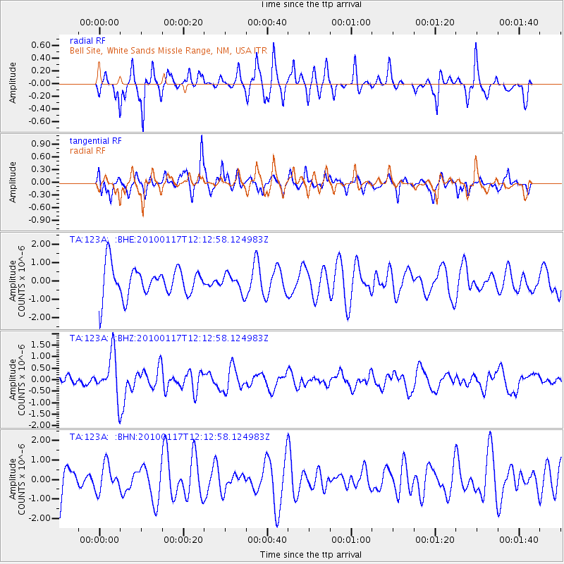
123A Bell Site, White Sands Missle Range, NM, USA - Earthquake Result Viewer
*The percent match for this event was below the threshold and hence no stack was calculated.
| Earthquake location: |
Drake Passage |
| Earthquake latitude/longitude: |
-57.7/-65.9 |
| Earthquake time(UTC): |
2010/01/17 (017) 12:00:01 GMT |
| Earthquake Depth: |
5.0 km |
| Earthquake Magnitude: |
6.0 MB, 6.0 MS, 6.3 MW, 6.3 MW |
| Earthquake Catalog/Contributor: |
WHDF/NEIC |
|
| Network: |
TA USArray Transportable Network (new EarthScope stations) |
| Station: |
123A Bell Site, White Sands Missle Range, NM, USA |
| Lat/Lon: |
32.63 N/106.26 W |
| Elevation: |
1206 m |
|
| Distance: |
96.2 deg |
| Az: |
326.644 deg |
| Baz: |
159.499 deg |
| Ray Param: |
$rayparam |
*The percent match for this event was below the threshold and hence was not used in the summary stack. |
|
| Radial Match: |
57.469585 % |
| Radial Bump: |
316 |
| Transverse Match: |
62.483883 % |
| Transverse Bump: |
363 |
| SOD ConfigId: |
296938 |
| Insert Time: |
2010-04-06 20:54:06.867 +0000 |
| GWidth: |
2.5 |
| Max Bumps: |
400 |
| Tol: |
0.001 |
|
Signal To Noise
| Channel | StoN | STA | LTA |
| TA:123A: :BHZ:20100117T12:12:58.124983Z | 5.330338 | 9.56249E-7 | 1.7939743E-7 |
| TA:123A: :BHN:20100117T12:12:58.124983Z | 0.9080935 | 6.930039E-7 | 7.631416E-7 |
| TA:123A: :BHE:20100117T12:12:58.124983Z | 0.6098525 | 4.9892833E-7 | 8.181131E-7 |
| Arrivals |
| Ps | |
| PpPs | |
| PsPs/PpSs | |


