You are here: Home > Network List > AV - Alaska Volcano Observatory Stations List
> Station MAPS Pakushin Southeast, Makushin Volcano, Alaska > Earthquake Result Viewer
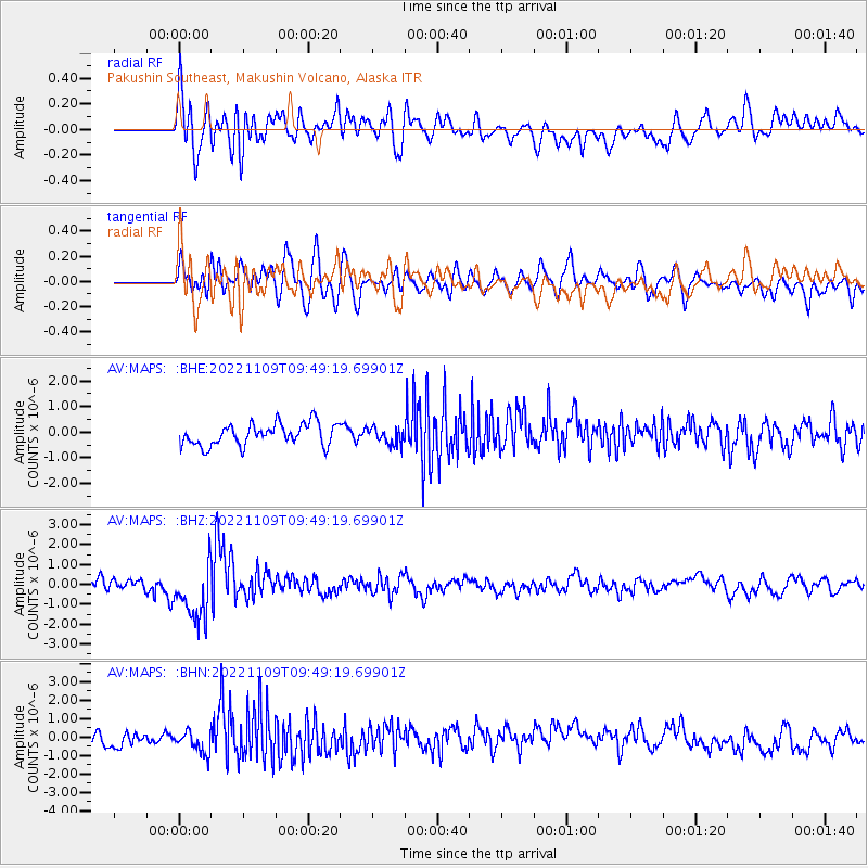
MAPS Pakushin Southeast, Makushin Volcano, Alaska - Earthquake Result Viewer
*The percent match for this event was below the threshold and hence no stack was calculated.
| Earthquake location: |
South Of Fiji Islands |
| Earthquake latitude/longitude: |
-26.0/178.4 |
| Earthquake time(UTC): |
2022/11/09 (313) 09:38:42 GMT |
| Earthquake Depth: |
629 km |
| Earthquake Magnitude: |
6.8 mww |
| Earthquake Catalog/Contributor: |
NEIC PDE/us |
|
| Network: |
AV Alaska Volcano Observatory |
| Station: |
MAPS Pakushin Southeast, Makushin Volcano, Alaska |
| Lat/Lon: |
53.81 N/166.94 W |
| Elevation: |
333 m |
|
| Distance: |
80.5 deg |
| Az: |
8.776 deg |
| Baz: |
193.391 deg |
| Ray Param: |
$rayparam |
*The percent match for this event was below the threshold and hence was not used in the summary stack. |
|
| Radial Match: |
64.32885 % |
| Radial Bump: |
400 |
| Transverse Match: |
58.954727 % |
| Transverse Bump: |
400 |
| SOD ConfigId: |
29734672 |
| Insert Time: |
2022-11-23 09:46:54.288 +0000 |
| GWidth: |
2.5 |
| Max Bumps: |
400 |
| Tol: |
0.001 |
|
Signal To Noise
| Channel | StoN | STA | LTA |
| AV:MAPS: :BHZ:20221109T09:49:19.69901Z | 6.21194 | 1.4420893E-6 | 2.3214798E-7 |
| AV:MAPS: :BHN:20221109T09:49:19.69901Z | 1.5465221 | 6.406112E-7 | 4.1422697E-7 |
| AV:MAPS: :BHE:20221109T09:49:19.69901Z | 0.73462266 | 3.1558005E-7 | 4.2958118E-7 |
| Arrivals |
| Ps | |
| PpPs | |
| PsPs/PpSs | |


