MM09 East Canton, Ohio - Earthquake Result Viewer
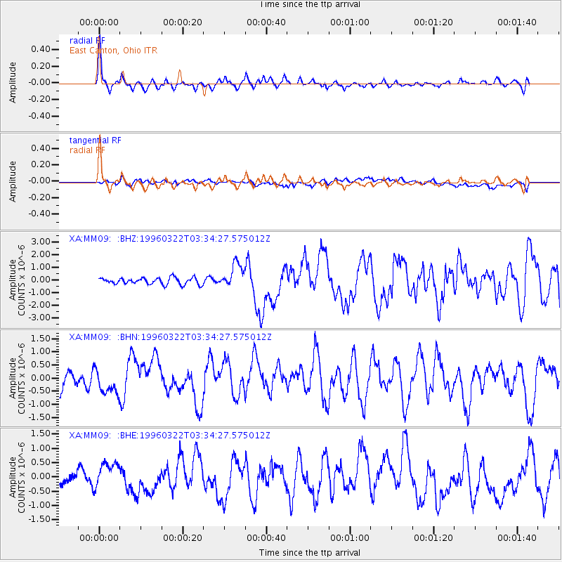
Earthquake location: Rat Islands, Aleutian Islands
Earthquake latitude/longitude: 51.2/178.7
Earthquake time(UTC): 1996/03/22 (082) 03:24:20 GMT
Earthquake Depth: 20 km
Earthquake Magnitude: 5.7 MB, 6.6 MS, 6.8 UNKNOWN, 6.6 ML
Earthquake Catalog/Contributor: WHDF/NEIC
Network: XA Missouri to Massachusetts Transect
Station: MM09 East Canton, Ohio
Lat/Lon: 40.79 N/81.21 W
Elevation: 357 m
Distance: 65.0 deg
Az: 55.55 deg
Baz: 316.921 deg
Ray Param: 0.058523312
Estimated Moho Depth: 37.0 km
Estimated Crust Vp/Vs: 1.93
Assumed Crust Vp: 6.483 km/s
Estimated Crust Vs: 3.359 km/s
Estimated Crust Poisson's Ratio: 0.32
Radial Match: 85.30699 %
Radial Bump: 400
Transverse Match: 46.02471 %
Transverse Bump: 400
SOD ConfigId: 6273
Insert Time: 2010-02-26 17:50:13.413 +0000
GWidth: 2.5
Max Bumps: 400
Tol: 0.001

Signal To Noise

ChannelStoNSTALTA
XA:MM09: :BHN:19960322T03:34:27.575012Z1.08140564.106733E-73.797588E-7
XA:MM09: :BHE:19960322T03:34:27.575012Z2.06037194.401369E-72.1362013E-7
XA:MM09: :BHZ:19960322T03:34:27.575012Z3.81171049.846184E-72.5831406E-7
Arrivals
Ps5.5 SECOND
PpPs16 SECOND
PsPs/PpSs22 SECOND