You are here: Home > Network List > US - United States National Seismic Network Stations List
> Station MSO Missoula, Montana, USA > Earthquake Result Viewer
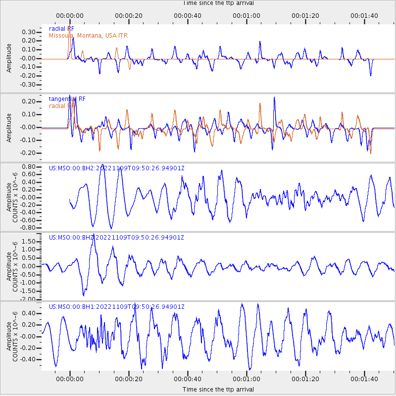
MSO Missoula, Montana, USA - Earthquake Result Viewer
*The percent match for this event was below the threshold and hence no stack was calculated.
| Earthquake location: |
South Of Fiji Islands |
| Earthquake latitude/longitude: |
-26.0/178.4 |
| Earthquake time(UTC): |
2022/11/09 (313) 09:38:42 GMT |
| Earthquake Depth: |
629 km |
| Earthquake Magnitude: |
6.8 mww |
| Earthquake Catalog/Contributor: |
NEIC PDE/us |
|
| Network: |
US United States National Seismic Network |
| Station: |
MSO Missoula, Montana, USA |
| Lat/Lon: |
46.83 N/113.94 W |
| Elevation: |
1264 m |
|
| Distance: |
94.7 deg |
| Az: |
39.598 deg |
| Baz: |
236.685 deg |
| Ray Param: |
$rayparam |
*The percent match for this event was below the threshold and hence was not used in the summary stack. |
|
| Radial Match: |
58.56747 % |
| Radial Bump: |
284 |
| Transverse Match: |
59.96541 % |
| Transverse Bump: |
400 |
| SOD ConfigId: |
29734672 |
| Insert Time: |
2022-11-23 10:06:45.521 +0000 |
| GWidth: |
2.5 |
| Max Bumps: |
400 |
| Tol: |
0.001 |
|
Signal To Noise
| Channel | StoN | STA | LTA |
| US:MSO:00:BHZ:20221109T09:50:26.94901Z | 2.5504642 | 6.2163326E-7 | 2.4373338E-7 |
| US:MSO:00:BH1:20221109T09:50:26.94901Z | 0.645298 | 1.4703909E-7 | 2.278623E-7 |
| US:MSO:00:BH2:20221109T09:50:26.94901Z | 0.7371548 | 3.1834557E-7 | 4.3185716E-7 |
| Arrivals |
| Ps | |
| PpPs | |
| PsPs/PpSs | |


