You are here: Home > Network List > KN - Kyrgyz Seismic Telemetry Network Stations List
> Station USP KN.USP > Earthquake Result Viewer
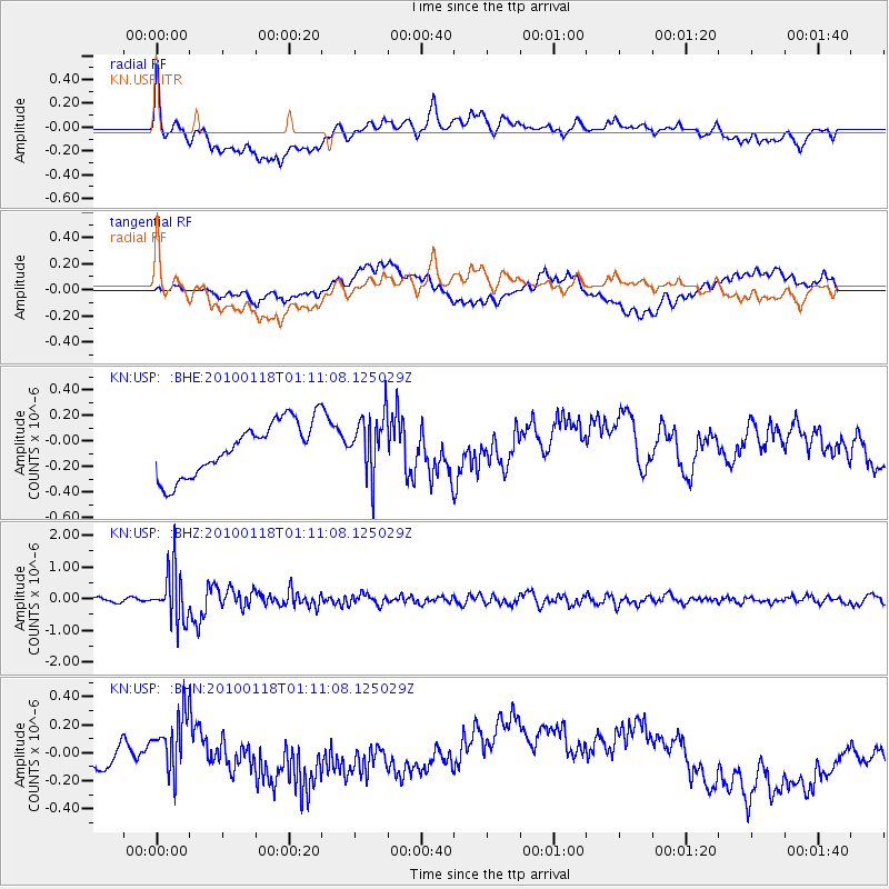
USP KN.USP - Earthquake Result Viewer
*The percent match for this event was below the threshold and hence no stack was calculated.
| Earthquake location: |
Kuril Islands |
| Earthquake latitude/longitude: |
46.5/153.3 |
| Earthquake time(UTC): |
2010/01/18 (018) 01:02:16 GMT |
| Earthquake Depth: |
7.0 km |
| Earthquake Magnitude: |
5.6 MB, 5.3 MS, 5.6 MW, 5.6 MW |
| Earthquake Catalog/Contributor: |
WHDF/NEIC |
|
| Network: |
KN Kyrgyz Seismic Telemetry Network |
| Station: |
USP KN.USP |
| Lat/Lon: |
43.27 N/74.50 E |
| Elevation: |
740 m |
|
| Distance: |
53.7 deg |
| Az: |
297.252 deg |
| Baz: |
57.245 deg |
| Ray Param: |
$rayparam |
*The percent match for this event was below the threshold and hence was not used in the summary stack. |
|
| Radial Match: |
50.21334 % |
| Radial Bump: |
400 |
| Transverse Match: |
34.060337 % |
| Transverse Bump: |
400 |
| SOD ConfigId: |
296938 |
| Insert Time: |
2010-04-06 21:09:25.725 +0000 |
| GWidth: |
2.5 |
| Max Bumps: |
400 |
| Tol: |
0.001 |
|
Signal To Noise
| Channel | StoN | STA | LTA |
| KN:USP: :BHZ:20100118T01:11:08.125029Z | 10.400732 | 7.9642956E-7 | 7.657437E-8 |
| KN:USP: :BHN:20100118T01:11:08.125029Z | 1.3067764 | 2.0015014E-7 | 1.5316327E-7 |
| KN:USP: :BHE:20100118T01:11:08.125029Z | 1.0925835 | 2.2749019E-7 | 2.0821308E-7 |
| Arrivals |
| Ps | |
| PpPs | |
| PsPs/PpSs | |


