You are here: Home > Network List > TA - USArray Transportable Network (new EarthScope stations) Stations List
> Station A20A Cobblestone Ranch, Loring, MT, USA > Earthquake Result Viewer
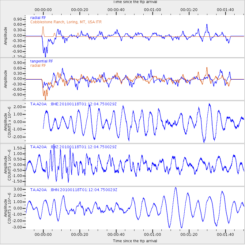
A20A Cobblestone Ranch, Loring, MT, USA - Earthquake Result Viewer
*The percent match for this event was below the threshold and hence no stack was calculated.
| Earthquake location: |
Kuril Islands |
| Earthquake latitude/longitude: |
46.5/153.3 |
| Earthquake time(UTC): |
2010/01/18 (018) 01:02:16 GMT |
| Earthquake Depth: |
7.0 km |
| Earthquake Magnitude: |
5.6 MB, 5.3 MS, 5.6 MW, 5.6 MW |
| Earthquake Catalog/Contributor: |
WHDF/NEIC |
|
| Network: |
TA USArray Transportable Network (new EarthScope stations) |
| Station: |
A20A Cobblestone Ranch, Loring, MT, USA |
| Lat/Lon: |
48.88 N/107.93 W |
| Elevation: |
868 m |
|
| Distance: |
61.8 deg |
| Az: |
47.77 deg |
| Baz: |
309.189 deg |
| Ray Param: |
$rayparam |
*The percent match for this event was below the threshold and hence was not used in the summary stack. |
|
| Radial Match: |
60.91231 % |
| Radial Bump: |
400 |
| Transverse Match: |
62.991047 % |
| Transverse Bump: |
373 |
| SOD ConfigId: |
296938 |
| Insert Time: |
2010-04-06 21:14:54.900 +0000 |
| GWidth: |
2.5 |
| Max Bumps: |
400 |
| Tol: |
0.001 |
|
Signal To Noise
| Channel | StoN | STA | LTA |
| TA:A20A: :BHZ:20100118T01:12:04.750029Z | 3.3570688 | 6.6332774E-7 | 1.9759135E-7 |
| TA:A20A: :BHN:20100118T01:12:04.750029Z | 0.90331054 | 8.832781E-7 | 9.778233E-7 |
| TA:A20A: :BHE:20100118T01:12:04.750029Z | 1.0465217 | 9.143505E-7 | 8.737043E-7 |
| Arrivals |
| Ps | |
| PpPs | |
| PsPs/PpSs | |


