You are here: Home > Network List > TA - USArray Transportable Network (new EarthScope stations) Stations List
> Station F28A McLaughlin, SD, USA > Earthquake Result Viewer
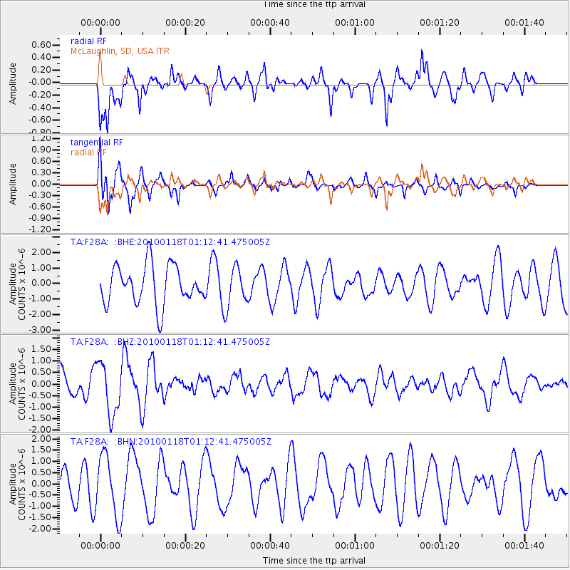
F28A McLaughlin, SD, USA - Earthquake Result Viewer
*The percent match for this event was below the threshold and hence no stack was calculated.
| Earthquake location: |
Kuril Islands |
| Earthquake latitude/longitude: |
46.5/153.3 |
| Earthquake time(UTC): |
2010/01/18 (018) 01:02:16 GMT |
| Earthquake Depth: |
7.0 km |
| Earthquake Magnitude: |
5.6 MB, 5.3 MS, 5.6 MW, 5.6 MW |
| Earthquake Catalog/Contributor: |
WHDF/NEIC |
|
| Network: |
TA USArray Transportable Network (new EarthScope stations) |
| Station: |
F28A McLaughlin, SD, USA |
| Lat/Lon: |
45.85 N/100.80 W |
| Elevation: |
633 m |
|
| Distance: |
67.4 deg |
| Az: |
46.72 deg |
| Baz: |
313.968 deg |
| Ray Param: |
$rayparam |
*The percent match for this event was below the threshold and hence was not used in the summary stack. |
|
| Radial Match: |
71.24779 % |
| Radial Bump: |
400 |
| Transverse Match: |
61.332302 % |
| Transverse Bump: |
374 |
| SOD ConfigId: |
296938 |
| Insert Time: |
2010-04-06 21:17:47.155 +0000 |
| GWidth: |
2.5 |
| Max Bumps: |
400 |
| Tol: |
0.001 |
|
Signal To Noise
| Channel | StoN | STA | LTA |
| TA:F28A: :BHZ:20100118T01:12:41.475005Z | 2.9439168 | 1.1302038E-6 | 3.839116E-7 |
| TA:F28A: :BHN:20100118T01:12:41.475005Z | 1.5186961 | 1.3707399E-6 | 9.025769E-7 |
| TA:F28A: :BHE:20100118T01:12:41.475005Z | 1.0425243 | 1.3064445E-6 | 1.2531549E-6 |
| Arrivals |
| Ps | |
| PpPs | |
| PsPs/PpSs | |


