You are here: Home > Network List > TA - USArray Transportable Network (new EarthScope stations) Stations List
> Station L31A Butterfield Farm, Chambers, NE, USA > Earthquake Result Viewer
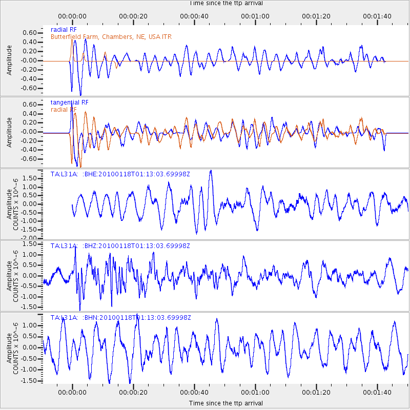
L31A Butterfield Farm, Chambers, NE, USA - Earthquake Result Viewer
*The percent match for this event was below the threshold and hence no stack was calculated.
| Earthquake location: |
Kuril Islands |
| Earthquake latitude/longitude: |
46.5/153.3 |
| Earthquake time(UTC): |
2010/01/18 (018) 01:02:16 GMT |
| Earthquake Depth: |
7.0 km |
| Earthquake Magnitude: |
5.6 MB, 5.3 MS, 5.6 MW, 5.6 MW |
| Earthquake Catalog/Contributor: |
WHDF/NEIC |
|
| Network: |
TA USArray Transportable Network (new EarthScope stations) |
| Station: |
L31A Butterfield Farm, Chambers, NE, USA |
| Lat/Lon: |
42.18 N/98.84 W |
| Elevation: |
670 m |
|
| Distance: |
71.0 deg |
| Az: |
48.429 deg |
| Baz: |
315.935 deg |
| Ray Param: |
$rayparam |
*The percent match for this event was below the threshold and hence was not used in the summary stack. |
|
| Radial Match: |
59.809986 % |
| Radial Bump: |
400 |
| Transverse Match: |
52.61067 % |
| Transverse Bump: |
400 |
| SOD ConfigId: |
296938 |
| Insert Time: |
2010-04-06 21:17:51.180 +0000 |
| GWidth: |
2.5 |
| Max Bumps: |
400 |
| Tol: |
0.001 |
|
Signal To Noise
| Channel | StoN | STA | LTA |
| TA:L31A: :BHZ:20100118T01:13:03.69998Z | 3.2690809 | 6.551143E-7 | 2.003971E-7 |
| TA:L31A: :BHN:20100118T01:13:03.69998Z | 0.6770972 | 4.5260154E-7 | 6.68444E-7 |
| TA:L31A: :BHE:20100118T01:13:03.69998Z | 1.6950481 | 8.823424E-7 | 5.205412E-7 |
| Arrivals |
| Ps | |
| PpPs | |
| PsPs/PpSs | |


