You are here: Home > Network List > TA - USArray Transportable Network (new EarthScope stations) Stations List
> Station 334A Lometa, TX, USA > Earthquake Result Viewer
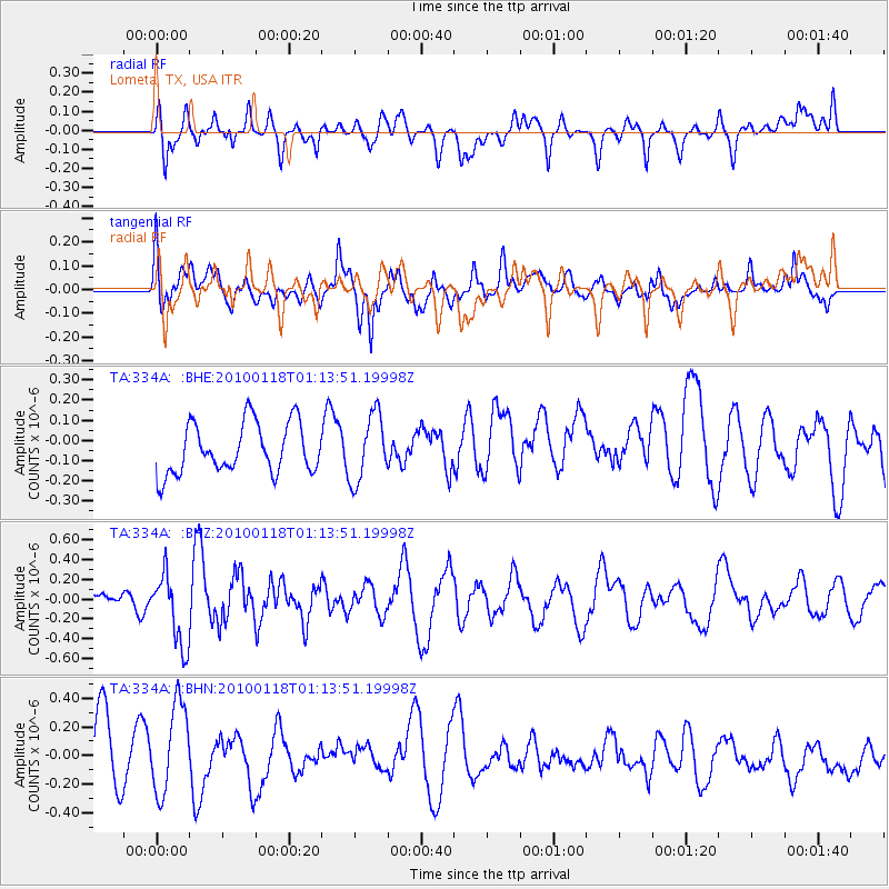
334A Lometa, TX, USA - Earthquake Result Viewer
*The percent match for this event was below the threshold and hence no stack was calculated.
| Earthquake location: |
Kuril Islands |
| Earthquake latitude/longitude: |
46.5/153.3 |
| Earthquake time(UTC): |
2010/01/18 (018) 01:02:16 GMT |
| Earthquake Depth: |
7.0 km |
| Earthquake Magnitude: |
5.6 MB, 5.3 MS, 5.6 MW, 5.6 MW |
| Earthquake Catalog/Contributor: |
WHDF/NEIC |
|
| Network: |
TA USArray Transportable Network (new EarthScope stations) |
| Station: |
334A Lometa, TX, USA |
| Lat/Lon: |
31.33 N/98.24 W |
| Elevation: |
389 m |
|
| Distance: |
79.3 deg |
| Az: |
55.687 deg |
| Baz: |
318.165 deg |
| Ray Param: |
$rayparam |
*The percent match for this event was below the threshold and hence was not used in the summary stack. |
|
| Radial Match: |
49.53532 % |
| Radial Bump: |
400 |
| Transverse Match: |
51.36188 % |
| Transverse Bump: |
400 |
| SOD ConfigId: |
296938 |
| Insert Time: |
2010-04-06 21:18:35.644 +0000 |
| GWidth: |
2.5 |
| Max Bumps: |
400 |
| Tol: |
0.001 |
|
Signal To Noise
| Channel | StoN | STA | LTA |
| TA:334A: :BHZ:20100118T01:13:51.19998Z | 3.324938 | 3.6174254E-7 | 1.08796776E-7 |
| TA:334A: :BHN:20100118T01:13:51.19998Z | 1.4655721 | 3.1354662E-7 | 2.1394146E-7 |
| TA:334A: :BHE:20100118T01:13:51.19998Z | 1.3337119 | 1.6525307E-7 | 1.2390461E-7 |
| Arrivals |
| Ps | |
| PpPs | |
| PsPs/PpSs | |


