You are here: Home > Network List > US - United States National Seismic Network Stations List
> Station HAWA Hanford, Washington, USA > Earthquake Result Viewer
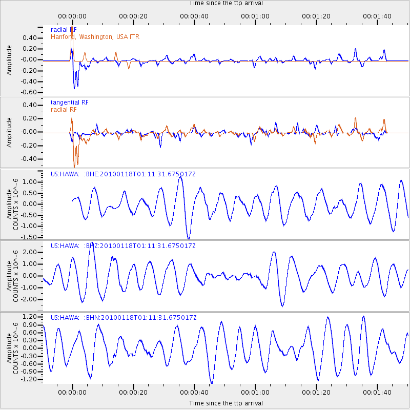
HAWA Hanford, Washington, USA - Earthquake Result Viewer
*The percent match for this event was below the threshold and hence no stack was calculated.
| Earthquake location: |
Kuril Islands |
| Earthquake latitude/longitude: |
46.5/153.3 |
| Earthquake time(UTC): |
2010/01/18 (018) 01:02:16 GMT |
| Earthquake Depth: |
7.0 km |
| Earthquake Magnitude: |
5.6 MB, 5.3 MS, 5.6 MW, 5.6 MW |
| Earthquake Catalog/Contributor: |
WHDF/NEIC |
|
| Network: |
US United States National Seismic Network |
| Station: |
HAWA Hanford, Washington, USA |
| Lat/Lon: |
46.39 N/119.53 W |
| Elevation: |
364 m |
|
| Distance: |
57.0 deg |
| Az: |
55.544 deg |
| Baz: |
304.592 deg |
| Ray Param: |
$rayparam |
*The percent match for this event was below the threshold and hence was not used in the summary stack. |
|
| Radial Match: |
76.953674 % |
| Radial Bump: |
400 |
| Transverse Match: |
76.73935 % |
| Transverse Bump: |
400 |
| SOD ConfigId: |
296938 |
| Insert Time: |
2010-04-06 21:19:28.395 +0000 |
| GWidth: |
2.5 |
| Max Bumps: |
400 |
| Tol: |
0.001 |
|
Signal To Noise
| Channel | StoN | STA | LTA |
| US:HAWA: :BHZ:20100118T01:11:31.675017Z | 2.553664 | 1.3667794E-6 | 5.3522285E-7 |
| US:HAWA: :BHN:20100118T01:11:31.675017Z | 0.9712051 | 3.8531994E-7 | 3.9674413E-7 |
| US:HAWA: :BHE:20100118T01:11:31.675017Z | 1.842019 | 6.368956E-7 | 3.4575953E-7 |
| Arrivals |
| Ps | |
| PpPs | |
| PsPs/PpSs | |


