You are here: Home > Network List > TA - USArray Transportable Network (new EarthScope stations) Stations List
> Station N26A Koester Ranch, Padroni, CO, USA > Earthquake Result Viewer
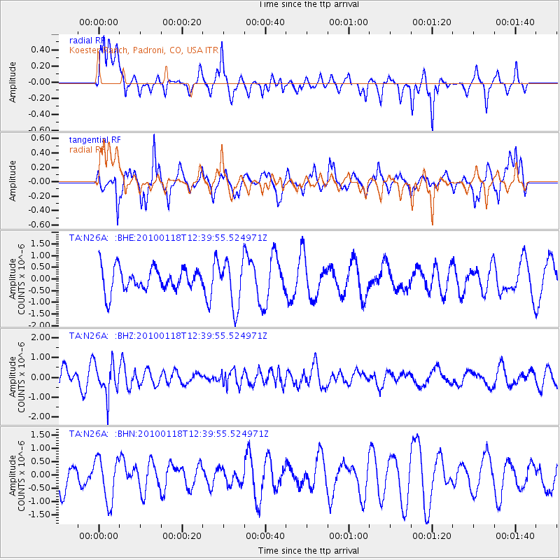
N26A Koester Ranch, Padroni, CO, USA - Earthquake Result Viewer
*The percent match for this event was below the threshold and hence no stack was calculated.
| Earthquake location: |
San Juan Province, Argentina |
| Earthquake latitude/longitude: |
-31.4/-68.6 |
| Earthquake time(UTC): |
2010/01/18 (018) 12:28:34 GMT |
| Earthquake Depth: |
94 km |
| Earthquake Magnitude: |
5.5 MB, 5.4 MW, 5.4 MW |
| Earthquake Catalog/Contributor: |
WHDF/NEIC |
|
| Network: |
TA USArray Transportable Network (new EarthScope stations) |
| Station: |
N26A Koester Ranch, Padroni, CO, USA |
| Lat/Lon: |
40.83 N/103.22 W |
| Elevation: |
1284 m |
|
| Distance: |
78.6 deg |
| Az: |
333.911 deg |
| Baz: |
150.278 deg |
| Ray Param: |
$rayparam |
*The percent match for this event was below the threshold and hence was not used in the summary stack. |
|
| Radial Match: |
70.66768 % |
| Radial Bump: |
399 |
| Transverse Match: |
61.26294 % |
| Transverse Bump: |
317 |
| SOD ConfigId: |
296938 |
| Insert Time: |
2010-04-06 21:29:16.208 +0000 |
| GWidth: |
2.5 |
| Max Bumps: |
400 |
| Tol: |
0.001 |
|
Signal To Noise
| Channel | StoN | STA | LTA |
| TA:N26A: :BHZ:20100118T12:39:55.524971Z | 1.7109783 | 7.9437405E-7 | 4.6428062E-7 |
| TA:N26A: :BHN:20100118T12:39:55.524971Z | 1.0533632 | 8.411675E-7 | 7.985541E-7 |
| TA:N26A: :BHE:20100118T12:39:55.524971Z | 2.0566697 | 1.0102178E-6 | 4.9119114E-7 |
| Arrivals |
| Ps | |
| PpPs | |
| PsPs/PpSs | |


