You are here: Home > Network List > US - United States National Seismic Network Stations List
> Station HAWA Hanford, Washington, USA > Earthquake Result Viewer
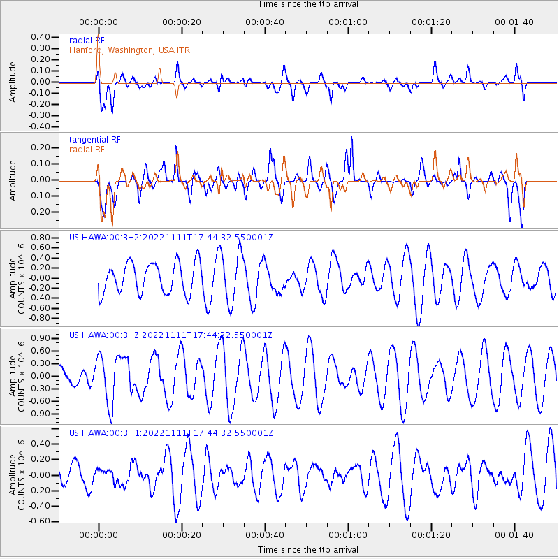
HAWA Hanford, Washington, USA - Earthquake Result Viewer
*The percent match for this event was below the threshold and hence no stack was calculated.
| Earthquake location: |
Ryukyu Islands, Japan |
| Earthquake latitude/longitude: |
25.0/128.8 |
| Earthquake time(UTC): |
2022/11/11 (315) 17:32:24 GMT |
| Earthquake Depth: |
14 km |
| Earthquake Magnitude: |
5.3 Mww |
| Earthquake Catalog/Contributor: |
NEIC PDE/us |
|
| Network: |
US United States National Seismic Network |
| Station: |
HAWA Hanford, Washington, USA |
| Lat/Lon: |
46.39 N/119.53 W |
| Elevation: |
364 m |
|
| Distance: |
85.9 deg |
| Az: |
40.156 deg |
| Baz: |
302.304 deg |
| Ray Param: |
$rayparam |
*The percent match for this event was below the threshold and hence was not used in the summary stack. |
|
| Radial Match: |
43.139587 % |
| Radial Bump: |
400 |
| Transverse Match: |
52.864887 % |
| Transverse Bump: |
400 |
| SOD ConfigId: |
29756493 |
| Insert Time: |
2022-11-25 17:54:26.879 +0000 |
| GWidth: |
2.5 |
| Max Bumps: |
400 |
| Tol: |
0.001 |
|
Signal To Noise
| Channel | StoN | STA | LTA |
| US:HAWA:00:BHZ:20221111T17:44:32.550001Z | 2.3698993 | 5.9355455E-7 | 2.504556E-7 |
| US:HAWA:00:BH1:20221111T17:44:32.550001Z | 0.55895555 | 7.815119E-8 | 1.3981646E-7 |
| US:HAWA:00:BH2:20221111T17:44:32.550001Z | 1.702683 | 5.07434E-7 | 2.9802024E-7 |
| Arrivals |
| Ps | |
| PpPs | |
| PsPs/PpSs | |


