You are here: Home > Network List > CI - Caltech Regional Seismic Network Stations List
> Station MPP McPhearson Peak > Earthquake Result Viewer
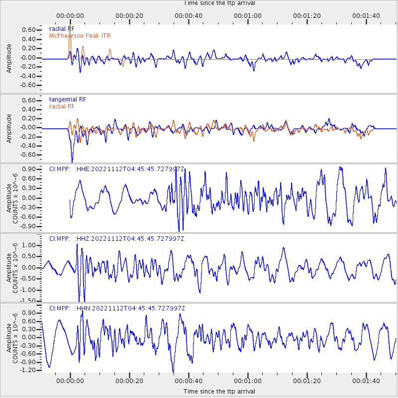
MPP McPhearson Peak - Earthquake Result Viewer
*The percent match for this event was below the threshold and hence no stack was calculated.
| Earthquake location: |
Guatemala |
| Earthquake latitude/longitude: |
14.1/-90.8 |
| Earthquake time(UTC): |
2022/11/12 (316) 04:39:47 GMT |
| Earthquake Depth: |
100 km |
| Earthquake Magnitude: |
5.8 mww |
| Earthquake Catalog/Contributor: |
NEIC PDE/us |
|
| Network: |
CI Caltech Regional Seismic Network |
| Station: |
MPP McPhearson Peak |
| Lat/Lon: |
34.89 N/119.81 W |
| Elevation: |
1739 m |
|
| Distance: |
33.3 deg |
| Az: |
313.469 deg |
| Baz: |
121.076 deg |
| Ray Param: |
$rayparam |
*The percent match for this event was below the threshold and hence was not used in the summary stack. |
|
| Radial Match: |
46.626297 % |
| Radial Bump: |
400 |
| Transverse Match: |
60.08839 % |
| Transverse Bump: |
400 |
| SOD ConfigId: |
29756493 |
| Insert Time: |
2022-11-26 04:52:24.798 +0000 |
| GWidth: |
2.5 |
| Max Bumps: |
400 |
| Tol: |
0.001 |
|
Signal To Noise
| Channel | StoN | STA | LTA |
| CI:MPP: :HHZ:20221112T04:45:45.727997Z | 2.1137648 | 6.5758474E-7 | 3.1109647E-7 |
| CI:MPP: :HHN:20221112T04:45:45.727997Z | 0.9200261 | 5.027412E-7 | 5.464423E-7 |
| CI:MPP: :HHE:20221112T04:45:45.727997Z | 0.90882117 | 2.5000705E-7 | 2.7508938E-7 |
| Arrivals |
| Ps | |
| PpPs | |
| PsPs/PpSs | |


