You are here: Home > Network List > IW - Intermountain West Stations List
> Station MOOW Moose Ponds, Wyoming, USA > Earthquake Result Viewer
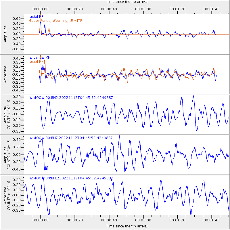
MOOW Moose Ponds, Wyoming, USA - Earthquake Result Viewer
*The percent match for this event was below the threshold and hence no stack was calculated.
| Earthquake location: |
Guatemala |
| Earthquake latitude/longitude: |
14.1/-90.8 |
| Earthquake time(UTC): |
2022/11/12 (316) 04:39:47 GMT |
| Earthquake Depth: |
100 km |
| Earthquake Magnitude: |
5.8 mww |
| Earthquake Catalog/Contributor: |
NEIC PDE/us |
|
| Network: |
IW Intermountain West |
| Station: |
MOOW Moose Ponds, Wyoming, USA |
| Lat/Lon: |
43.75 N/110.74 W |
| Elevation: |
2128 m |
|
| Distance: |
34.1 deg |
| Az: |
333.829 deg |
| Baz: |
143.812 deg |
| Ray Param: |
$rayparam |
*The percent match for this event was below the threshold and hence was not used in the summary stack. |
|
| Radial Match: |
52.95405 % |
| Radial Bump: |
400 |
| Transverse Match: |
57.07634 % |
| Transverse Bump: |
400 |
| SOD ConfigId: |
29756493 |
| Insert Time: |
2022-11-26 04:58:03.935 +0000 |
| GWidth: |
2.5 |
| Max Bumps: |
400 |
| Tol: |
0.001 |
|
Signal To Noise
| Channel | StoN | STA | LTA |
| IW:MOOW:00:BHZ:20221112T04:45:52.424988Z | 2.437747 | 3.3416936E-7 | 1.3708123E-7 |
| IW:MOOW:00:BH1:20221112T04:45:52.424988Z | 2.1765754 | 2.3394843E-7 | 1.0748464E-7 |
| IW:MOOW:00:BH2:20221112T04:45:52.424988Z | 1.086965 | 1.0994283E-7 | 1.01146625E-7 |
| Arrivals |
| Ps | |
| PpPs | |
| PsPs/PpSs | |


