You are here: Home > Network List > US - United States National Seismic Network Stations List
> Station DGMT Dagmar, Montana, USA > Earthquake Result Viewer
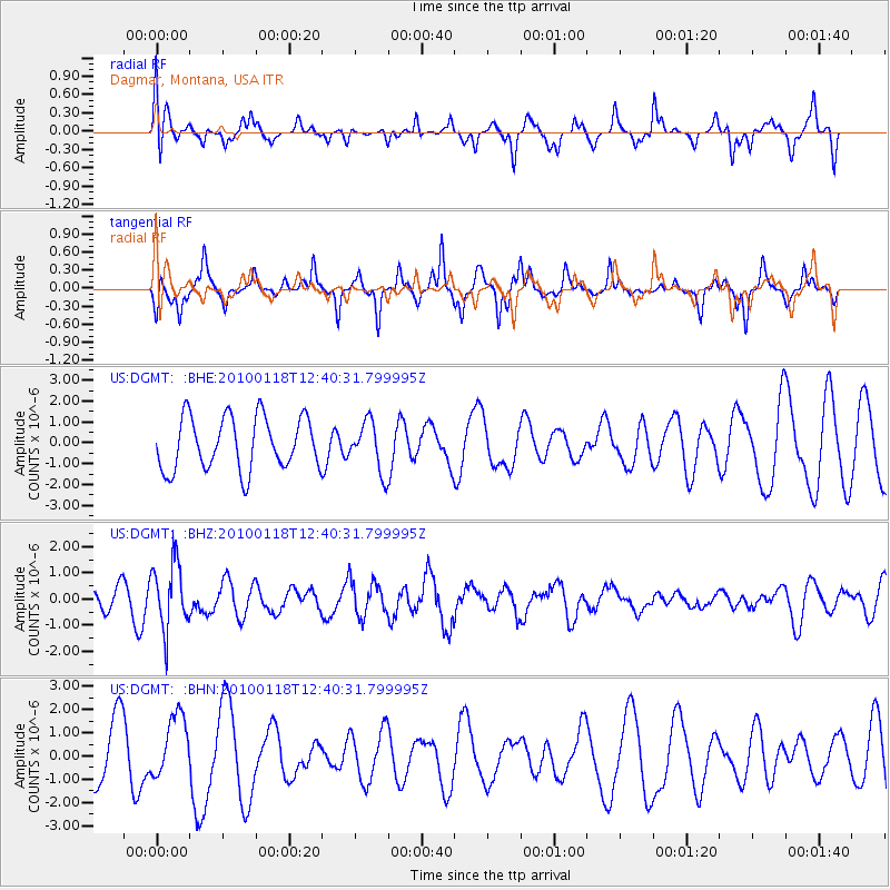
DGMT Dagmar, Montana, USA - Earthquake Result Viewer
*The percent match for this event was below the threshold and hence no stack was calculated.
| Earthquake location: |
San Juan Province, Argentina |
| Earthquake latitude/longitude: |
-31.4/-68.6 |
| Earthquake time(UTC): |
2010/01/18 (018) 12:28:34 GMT |
| Earthquake Depth: |
94 km |
| Earthquake Magnitude: |
5.5 MB, 5.4 MW, 5.4 MW |
| Earthquake Catalog/Contributor: |
WHDF/NEIC |
|
| Network: |
US United States National Seismic Network |
| Station: |
DGMT Dagmar, Montana, USA |
| Lat/Lon: |
48.47 N/104.20 W |
| Elevation: |
0.0 m |
|
| Distance: |
85.6 deg |
| Az: |
337.138 deg |
| Baz: |
150.038 deg |
| Ray Param: |
$rayparam |
*The percent match for this event was below the threshold and hence was not used in the summary stack. |
|
| Radial Match: |
62.444008 % |
| Radial Bump: |
400 |
| Transverse Match: |
56.583694 % |
| Transverse Bump: |
267 |
| SOD ConfigId: |
296938 |
| Insert Time: |
2010-04-06 21:38:22.112 +0000 |
| GWidth: |
2.5 |
| Max Bumps: |
400 |
| Tol: |
0.001 |
|
Signal To Noise
| Channel | StoN | STA | LTA |
| US:DGMT: :BHZ:20100118T12:40:31.799995Z | 2.6072378 | 1.2647496E-6 | 4.850918E-7 |
| US:DGMT: :BHN:20100118T12:40:31.799995Z | 0.7926615 | 1.3592004E-6 | 1.7147299E-6 |
| US:DGMT: :BHE:20100118T12:40:31.799995Z | 0.93859535 | 1.184742E-6 | 1.2622501E-6 |
| Arrivals |
| Ps | |
| PpPs | |
| PsPs/PpSs | |


