You are here: Home > Network List > CI - Caltech Regional Seismic Network Stations List
> Station DAN Danby, California, USA > Earthquake Result Viewer
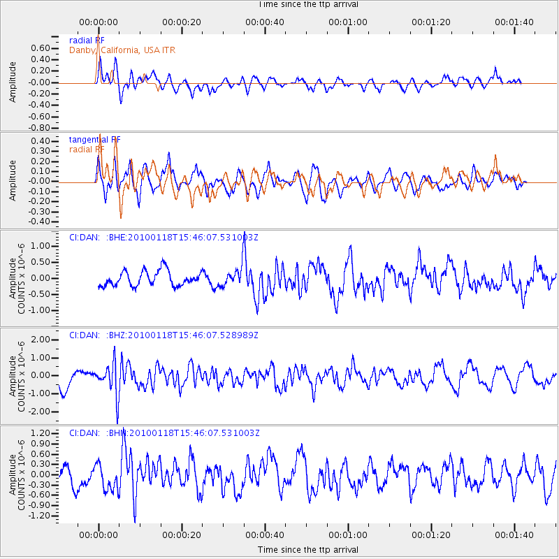
DAN Danby, California, USA - Earthquake Result Viewer
*The percent match for this event was below the threshold and hence no stack was calculated.
| Earthquake location: |
Near Coast Of Guatemala |
| Earthquake latitude/longitude: |
13.7/-90.1 |
| Earthquake time(UTC): |
2010/01/18 (018) 15:40:26 GMT |
| Earthquake Depth: |
55 km |
| Earthquake Magnitude: |
5.9 MW, 5.4 MB, 5.8 MW |
| Earthquake Catalog/Contributor: |
WHDF/NEIC |
|
| Network: |
CI Caltech Regional Seismic Network |
| Station: |
DAN Danby, California, USA |
| Lat/Lon: |
34.64 N/115.38 W |
| Elevation: |
398 m |
|
| Distance: |
30.9 deg |
| Az: |
316.757 deg |
| Baz: |
126.154 deg |
| Ray Param: |
$rayparam |
*The percent match for this event was below the threshold and hence was not used in the summary stack. |
|
| Radial Match: |
65.605804 % |
| Radial Bump: |
400 |
| Transverse Match: |
66.726685 % |
| Transverse Bump: |
400 |
| SOD ConfigId: |
296938 |
| Insert Time: |
2010-04-06 21:41:23.793 +0000 |
| GWidth: |
2.5 |
| Max Bumps: |
400 |
| Tol: |
0.001 |
|
Signal To Noise
| Channel | StoN | STA | LTA |
| CI:DAN: :BHZ:20100118T15:46:07.528989Z | 1.8608254 | 8.7857654E-7 | 4.7214345E-7 |
| CI:DAN: :BHN:20100118T15:46:07.531003Z | 1.4588381 | 3.8763233E-7 | 2.6571306E-7 |
| CI:DAN: :BHE:20100118T15:46:07.531003Z | 1.390868 | 3.2351585E-7 | 2.3259996E-7 |
| Arrivals |
| Ps | |
| PpPs | |
| PsPs/PpSs | |


