You are here: Home > Network List > TA - USArray Transportable Network (new EarthScope stations) Stations List
> Station G24A Alzada, MT, USA > Earthquake Result Viewer
G24A Alzada, MT, USA - Earthquake Result Viewer
*The percent match for this event was below the threshold and hence no stack was calculated.
| Earthquake location: |
Near Coast Of Guatemala |
| Earthquake latitude/longitude: |
13.7/-90.1 |
| Earthquake time(UTC): |
2010/01/18 (018) 15:40:26 GMT |
| Earthquake Depth: |
55 km |
| Earthquake Magnitude: |
5.9 MW, 5.4 MB, 5.8 MW |
| Earthquake Catalog/Contributor: |
WHDF/NEIC |
|
| Network: |
TA USArray Transportable Network (new EarthScope stations) |
| Station: |
G24A Alzada, MT, USA |
| Lat/Lon: |
45.33 N/104.42 W |
| Elevation: |
1147 m |
|
| Distance: |
33.7 deg |
| Az: |
341.742 deg |
| Baz: |
154.431 deg |
| Ray Param: |
$rayparam |
*The percent match for this event was below the threshold and hence was not used in the summary stack. |
|
| Radial Match: |
62.74654 % |
| Radial Bump: |
331 |
| Transverse Match: |
62.46684 % |
| Transverse Bump: |
386 |
| SOD ConfigId: |
296938 |
| Insert Time: |
2010-04-06 21:45:15.171 +0000 |
| GWidth: |
2.5 |
| Max Bumps: |
400 |
| Tol: |
0.001 |
|
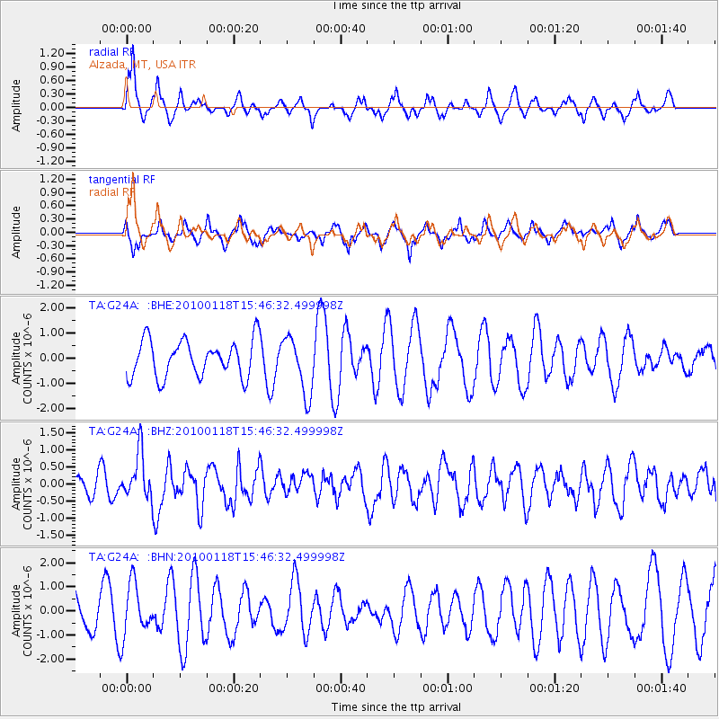
Signal To Noise
| Channel | StoN | STA | LTA |
| TA:G24A: :BHZ:20100118T15:46:32.499998Z | 2.5443761 | 6.96609E-7 | 2.7378383E-7 |
| TA:G24A: :BHN:20100118T15:46:32.499998Z | 1.378648 | 1.0473993E-6 | 7.597293E-7 |
| TA:G24A: :BHE:20100118T15:46:32.499998Z | 1.5813148 | 1.1475338E-6 | 7.256834E-7 |
| Arrivals |
| Ps | |
| PpPs | |
| PsPs/PpSs | |


