You are here: Home > Network List > TA - USArray Transportable Network (new EarthScope stations) Stations List
> Station D30A Buchanan, ND, USA > Earthquake Result Viewer
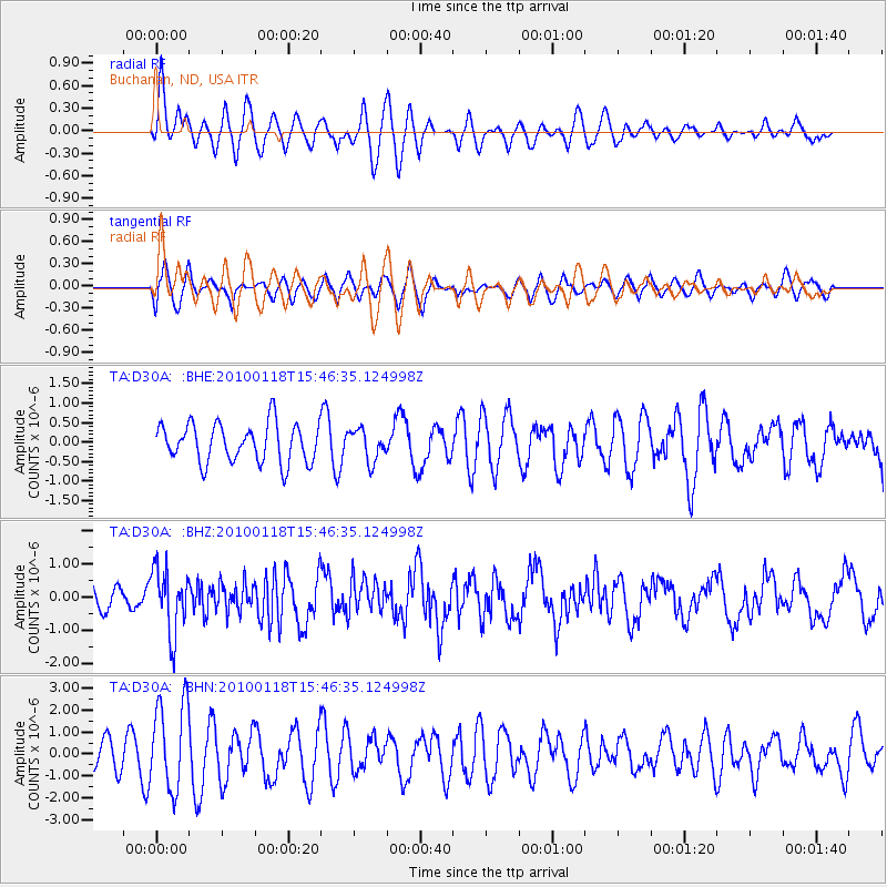
D30A Buchanan, ND, USA - Earthquake Result Viewer
*The percent match for this event was below the threshold and hence no stack was calculated.
| Earthquake location: |
Near Coast Of Guatemala |
| Earthquake latitude/longitude: |
13.7/-90.1 |
| Earthquake time(UTC): |
2010/01/18 (018) 15:40:26 GMT |
| Earthquake Depth: |
55 km |
| Earthquake Magnitude: |
5.9 MW, 5.4 MB, 5.8 MW |
| Earthquake Catalog/Contributor: |
WHDF/NEIC |
|
| Network: |
TA USArray Transportable Network (new EarthScope stations) |
| Station: |
D30A Buchanan, ND, USA |
| Lat/Lon: |
47.11 N/98.76 W |
| Elevation: |
465 m |
|
| Distance: |
34.1 deg |
| Az: |
349.458 deg |
| Baz: |
164.913 deg |
| Ray Param: |
$rayparam |
*The percent match for this event was below the threshold and hence was not used in the summary stack. |
|
| Radial Match: |
52.39455 % |
| Radial Bump: |
400 |
| Transverse Match: |
49.08162 % |
| Transverse Bump: |
400 |
| SOD ConfigId: |
296938 |
| Insert Time: |
2010-04-06 21:46:03.497 +0000 |
| GWidth: |
2.5 |
| Max Bumps: |
400 |
| Tol: |
0.001 |
|
Signal To Noise
| Channel | StoN | STA | LTA |
| TA:D30A: :BHZ:20100118T15:46:35.124998Z | 2.5160844 | 9.633196E-7 | 3.8286458E-7 |
| TA:D30A: :BHN:20100118T15:46:35.124998Z | 2.9291742 | 2.0204022E-6 | 6.897515E-7 |
| TA:D30A: :BHE:20100118T15:46:35.124998Z | 0.8035197 | 3.9801475E-7 | 4.953391E-7 |
| Arrivals |
| Ps | |
| PpPs | |
| PsPs/PpSs | |


