You are here: Home > Network List > TA - USArray Transportable Network (new EarthScope stations) Stations List
> Station K30A Basset, NE, USA > Earthquake Result Viewer
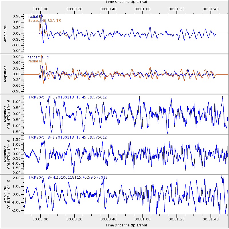
K30A Basset, NE, USA - Earthquake Result Viewer
*The percent match for this event was below the threshold and hence no stack was calculated.
| Earthquake location: |
Near Coast Of Guatemala |
| Earthquake latitude/longitude: |
13.7/-90.1 |
| Earthquake time(UTC): |
2010/01/18 (018) 15:40:26 GMT |
| Earthquake Depth: |
55 km |
| Earthquake Magnitude: |
5.9 MW, 5.4 MB, 5.8 MW |
| Earthquake Catalog/Contributor: |
WHDF/NEIC |
|
| Network: |
TA USArray Transportable Network (new EarthScope stations) |
| Station: |
K30A Basset, NE, USA |
| Lat/Lon: |
42.67 N/99.61 W |
| Elevation: |
712 m |
|
| Distance: |
30.0 deg |
| Az: |
345.932 deg |
| Baz: |
161.319 deg |
| Ray Param: |
$rayparam |
*The percent match for this event was below the threshold and hence was not used in the summary stack. |
|
| Radial Match: |
48.76307 % |
| Radial Bump: |
400 |
| Transverse Match: |
49.946266 % |
| Transverse Bump: |
400 |
| SOD ConfigId: |
296938 |
| Insert Time: |
2010-04-06 21:47:05.845 +0000 |
| GWidth: |
2.5 |
| Max Bumps: |
400 |
| Tol: |
0.001 |
|
Signal To Noise
| Channel | StoN | STA | LTA |
| TA:K30A: :BHZ:20100118T15:45:59.57501Z | 3.7083132 | 1.0273451E-6 | 2.770384E-7 |
| TA:K30A: :BHN:20100118T15:45:59.57501Z | 1.8986378 | 1.2425533E-6 | 6.544446E-7 |
| TA:K30A: :BHE:20100118T15:45:59.57501Z | 0.66812724 | 4.2538596E-7 | 6.366841E-7 |
| Arrivals |
| Ps | |
| PpPs | |
| PsPs/PpSs | |


