You are here: Home > Network List > US - United States National Seismic Network Stations List
> Station HAWA Hanford, Washington, USA > Earthquake Result Viewer
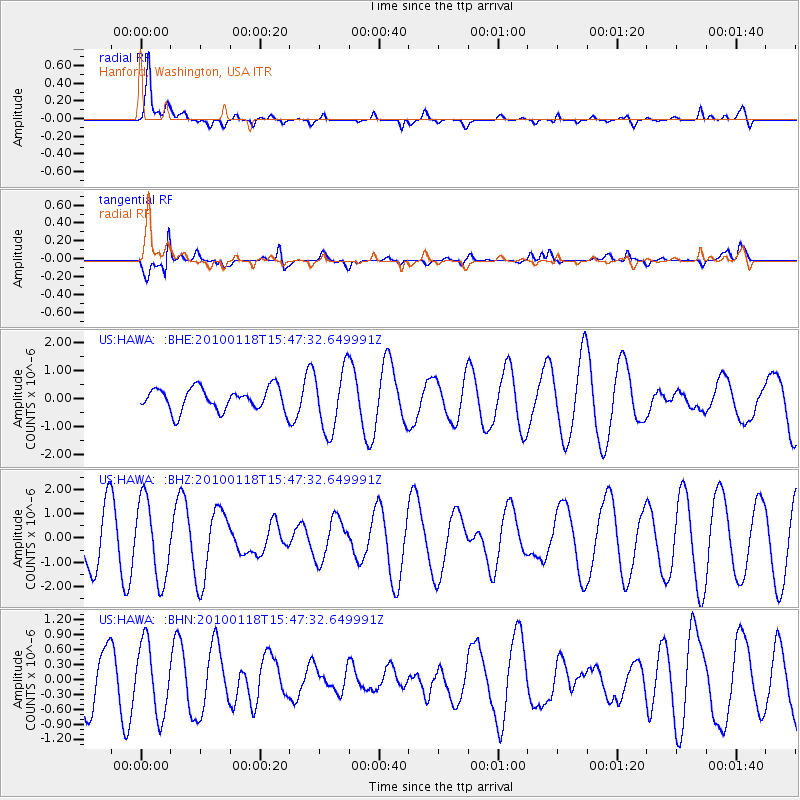
HAWA Hanford, Washington, USA - Earthquake Result Viewer
*The percent match for this event was below the threshold and hence no stack was calculated.
| Earthquake location: |
Near Coast Of Guatemala |
| Earthquake latitude/longitude: |
13.7/-90.1 |
| Earthquake time(UTC): |
2010/01/18 (018) 15:40:26 GMT |
| Earthquake Depth: |
55 km |
| Earthquake Magnitude: |
5.9 MW, 5.4 MB, 5.8 MW |
| Earthquake Catalog/Contributor: |
WHDF/NEIC |
|
| Network: |
US United States National Seismic Network |
| Station: |
HAWA Hanford, Washington, USA |
| Lat/Lon: |
46.39 N/119.53 W |
| Elevation: |
364 m |
|
| Distance: |
40.9 deg |
| Az: |
328.717 deg |
| Baz: |
133.191 deg |
| Ray Param: |
$rayparam |
*The percent match for this event was below the threshold and hence was not used in the summary stack. |
|
| Radial Match: |
80.745514 % |
| Radial Bump: |
400 |
| Transverse Match: |
79.30098 % |
| Transverse Bump: |
400 |
| SOD ConfigId: |
296938 |
| Insert Time: |
2010-04-06 21:47:26.507 +0000 |
| GWidth: |
2.5 |
| Max Bumps: |
400 |
| Tol: |
0.001 |
|
Signal To Noise
| Channel | StoN | STA | LTA |
| US:HAWA: :BHZ:20100118T15:47:32.649991Z | 1.574546 | 1.6179715E-6 | 1.0275797E-6 |
| US:HAWA: :BHN:20100118T15:47:32.649991Z | 1.35323 | 7.0483947E-7 | 5.2085704E-7 |
| US:HAWA: :BHE:20100118T15:47:32.649991Z | 2.71556 | 1.0998566E-6 | 4.050202E-7 |
| Arrivals |
| Ps | |
| PpPs | |
| PsPs/PpSs | |


