You are here: Home > Network List > IU - Global Seismograph Network (GSN - IRIS/USGS) Stations List
> Station POHA Pohakuloa, Hawaii, USA > Earthquake Result Viewer
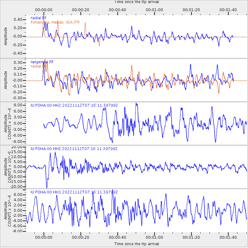
POHA Pohakuloa, Hawaii, USA - Earthquake Result Viewer
*The percent match for this event was below the threshold and hence no stack was calculated.
| Earthquake location: |
Fiji Islands Region |
| Earthquake latitude/longitude: |
-20.1/-178.4 |
| Earthquake time(UTC): |
2022/11/12 (316) 07:09:14 GMT |
| Earthquake Depth: |
587 km |
| Earthquake Magnitude: |
7.0 mww |
| Earthquake Catalog/Contributor: |
NEIC PDE/us |
|
| Network: |
IU Global Seismograph Network (GSN - IRIS/USGS) |
| Station: |
POHA Pohakuloa, Hawaii, USA |
| Lat/Lon: |
19.76 N/155.53 W |
| Elevation: |
1990 m |
|
| Distance: |
45.5 deg |
| Az: |
30.819 deg |
| Baz: |
210.743 deg |
| Ray Param: |
$rayparam |
*The percent match for this event was below the threshold and hence was not used in the summary stack. |
|
| Radial Match: |
66.39858 % |
| Radial Bump: |
400 |
| Transverse Match: |
54.610622 % |
| Transverse Bump: |
400 |
| SOD ConfigId: |
29756493 |
| Insert Time: |
2022-11-26 07:31:42.988 +0000 |
| GWidth: |
2.5 |
| Max Bumps: |
400 |
| Tol: |
0.001 |
|
Signal To Noise
| Channel | StoN | STA | LTA |
| IU:POHA:00:HHZ:20221112T07:16:11.39799Z | 5.03405 | 8.770833E-6 | 1.7423016E-6 |
| IU:POHA:00:HH1:20221112T07:16:11.39799Z | 0.7919998 | 2.5144225E-6 | 3.1747766E-6 |
| IU:POHA:00:HH2:20221112T07:16:11.39799Z | 2.1103473 | 4.4669036E-6 | 2.1166675E-6 |
| Arrivals |
| Ps | |
| PpPs | |
| PsPs/PpSs | |


